How to get by car to Montana Snowbowl?
Montana Snowbowl is a ski resort at an elevation of 1,520m (4,986ft) above sea level, located in Missoula County, in the U.S. state of Montana.
Where is Montana Snowbowl?
The resort is located northwest of Missoula, in the western part of Montana. It is the starting point for the roads to TV Mountain (a mountain at an elevation of 2,081m / 6,827ft above sea level) and Point Six (a mountain at an elevation of 2,421m / 7,942ft above sea level).
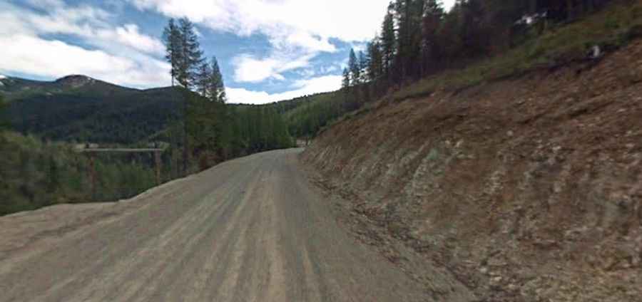
Is the road to Montana Snowbowl unpaved?
The road to the alpine ski area is called Montana Snowbowl Road. It’s steep, and its surface is mostly gravel. The first couple of miles are paved, while the remaining 5 miles are along a gravel road. The access road was significantly improved as of 2011.
How challenging is the road to Montana Snowbowl?
The road can be a little rough in places depending on how much snow has fallen. Caution should be exercised when driving the Snowbowl Road because of the steep inclines and icy conditions often present. The drive is a bit twisty, but reasonably wide and well plowed. Drivers should be especially cautious of oncoming traffic.
How long is the road to Montana Snowbowl?
Starting from Grant Creek Road, the road to the ski station is 9.01km (5.6 miles) long. Over this distance, the elevation gain is 356 meters. The average gradient is 3.95%.