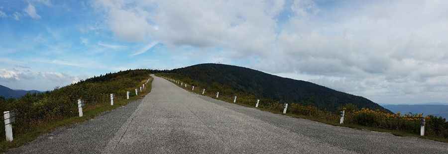
A steep paved toll-road to the top of Equinox Mountain in Vermont
Mount Equinox is a mountain peak at an elevation of 1,170m (3,840ft) above sea level, located in Bennington County, in the U.S. state of Vermont. The climb is brutal, with some sections up to 14.66%. It’s an unforgettable drive to the summit of the highest peak in the Taconic Range. It’s one of the highest roads in Vermont.

Can you drive to the top of Mount Equinox?
Tucked away in the southern part of Vermont, the road to the summit is totally paved. It’s called Mount Equinox Skyline Drive. It’s a toll road built in 1947. The road is 8.36km (5.2 miles) long, starting right off of Route 7A, in Sunderland (to the south of Manchester). The road is owned by the Carthusian Order and remains as the longest privately-owned paved toll road in the United States.
Is the road to Mount Equinox open?
Set high in the Taconic Range, part of the Appalachian Mountains, the road to the summit is closed from November through April. Buses, RVs, or vans over 8 persons are strictly prohibited. Vehicles carrying bikes, canoes, or kayaks are not permitted. From Memorial Day Weekend to October 31st, it is open from 9:00 AM to 5:00 PM daily (weather permitting). It is typically breezy all year long, so a light jacket is a good thing to have with you on this drive.
Is the road to Mount Equinox worth it?
Located within the Green Mountain National Forest, there are wide views from the side of the road as it goes along the top of the ridge. As you drive up, there are several paved pull-off areas to park and enjoy some of the views. There is a parking lot at the top. At the summit, there are communication towers, a small, abandoned Cold War-era NORAD radar station, and an unmanned info center with information about the mountain, the views, and the history. The summit has a full 360-degree view of Vermont, the Adirondacks, and New Hampshire. From the summit, you’re able to see five different states as well as Canada.
Is the road to Mount Equinox steep?
It’s said to be the hardest and steepest bike climb in Vermont. Starting at VT-7A road, the elevation gain is 970 meters (3,182 ft). The average gradient is 11.38%, with some parts up to 14.66%. Coming down, it is a good idea to stop halfway down and let your brakes cool down. Use them intermittently but firmly as needed. Be sure your vehicle is in its lowest gear so its engine will act as a brake.
Pic: Kristofer Soberano