Driving the Scenic Lamoille Canyon Road in Nevada
Lamoille Canyon Road is a very scenic mountain road located in Elko County, in the US state of Nevada.
Where is Lamoille Canyon Road?
The road, also known as Lamoille Canyon Scenic Byway and National Forest Development Road 660 (NF 660), is located in the northeastern corner of Nevada, within the Humboldt-Toiyabe National Forest.
When Was Lamoille Canyon Road Built?
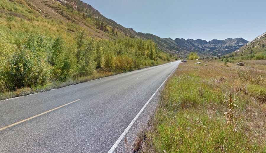
Lamoille Canyon Road was built between 1930 and 1940. Throughout the short drive, travelers are rewarded with superb views. Along the way, you’ll pass a few large avalanche chutes, lots of wildlife, and several waterfalls.
Is the Lamoille Canyon Road Paved?
The winding mountain road is completely paved, though it is old and has some repair patches. It is an undivided, two-lane road (one lane in each direction) with a speed limit of 35 mph (56 km/h). Traffic ranges from light to moderate, depending on the season.
How Long is the Lamoille Canyon Road?
The road starts from Lamoille Highway, just west of the small town of Lamoille. It’s 19.63 km (12.2 miles) long, running along the Lamoille Creek. At the end of the paved road, there’s a parking lot for visitors.
Is the Lamoille Canyon Road Steep?
The winding road features many steep sections, with some ramps hitting a 15% grade. Starting from Lamoille Highway, at 1,807m (5,928 ft) above sea level, the elevation gain is 879 meters. The average gradient is 4.47%. Be prepared for lots of climbing in one direction and white-knuckle descending in the other.
Is the Lamoille Canyon Road Open?
Located in the heart of the Ruby Mountains, Nevada’s wettest mountain range, the road is not plowed in winter. It tops out at 2,686m (8,812 ft) above sea level. Be prepared for snow and be cautious of avalanche danger after storms or mudslides after heavy rain. Motor vehicle access to the upper end of the road is generally limited to the months of June through October.