The steep road to Donner Pass in California
Donner Pass is a high mountain pass at an elevation of 2,210m (7,250ft) above sea level, located in Nevada County, in the U.S. state of California.
Where is Donner Pass?
The pass is located on the eastern part of California, within the Tahoe National Forest. The pass gets its name from the ill-fated Donner Party who overwintered there in 1846.
How long is Donner Pass in California?
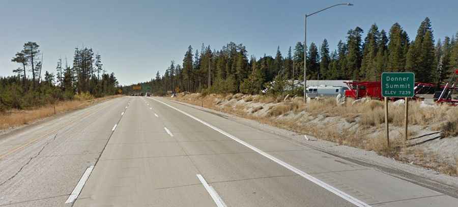
The road to the summit, also known as Donner Summit, is totally paved. It’s called Interstate 80. The pass is 24.14km (15 miles) long, running east-west from Truckee to Kingvale.
Is Donner Pass in California open?
Set high in the northern Sierra Nevada, the pass is open year-round, but conditions on the pass in the winter often cause temporary closures or require you to use chains on your tires. Winters at the summit can be brutal, as it’s one of the snowiest places in the contiguous United States.
Is Donner Pass dangerous?
It’s usually known as one of the more dangerous areas for truck drivers and is the site of many fatal accidents. The pass has a steep approach from the east and a gradual approach from the west.