The Ultimate Guide to Traveling the historic Sangre de Cristo Pass of Colorado
Sangre de Cristo Pass is a high mountain pass at an elevation of 2.886m (9,468ft) above sea level, located in the US state of Colorado.

Where is Sangre de Cristo Pass?
The pass is located on the boundary of Costilla and Huerfano counties, in the south-central part of Colorado, near the border with New Mexico. It serves as a natural divide between the San Luis Valley to the west and the Wet Mountain Valley to the east.
Why is it called Sangre de Cristo Pass?
The name "Sangre de Cristo" (Spanish for "Blood of Christ") was given to the mountain range by Spanish settlers, likely due to the reddish hues the mountains take on during sunrise and sunset. The pass has historical importance as it was used by Native American tribes, Spanish explorers, and later European settlers. It was part of the route used by early Spanish explorers heading north from New Mexico into Colorado and was the site of a Spanish Fort of 1819.
Is the road to Sangre de Cristo Pass paved?
The road to the summit is totally paved. It’s called U.S. Highway 160. It is now the principal highway route through this part of the mountain range.
Is the road to Sangre de Cristo Pass open in winter?
Set high in the Sangre de Cristo Mountains, part of the larger Rocky Mountain range, the road is usually open in winter. It experiences harsh weather conditions, especially in winter, with snow and ice making the road treacherous.
Is Sangre de Cristo Pass challenging?
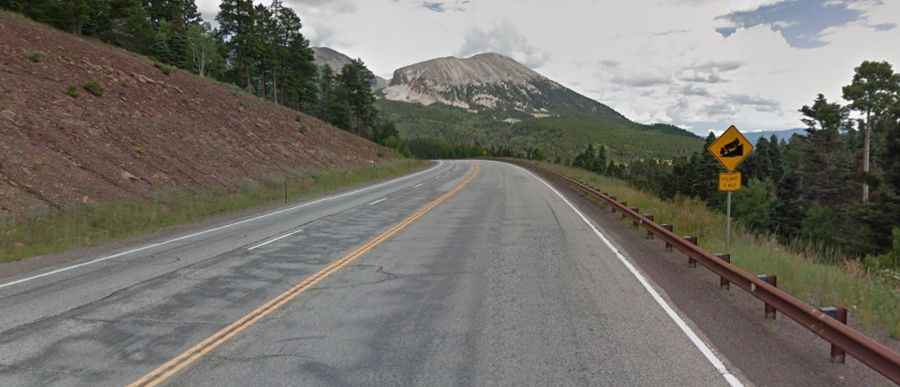
Located to the north of North La Veta Pass, it’s a two lane road, well maintained, with no sharp turns, but going through territory where a road was not intended by Mother Nature. The drive is very scenic but preferably to drive it at night so as not to see the steep drops at the side of the road.
How long is Sangre de Cristo Pass in Colorado?
The road is 77.24km (48.0 miles) long running west-east from Fort Garland (in Costilla County) to the City of Walsenburg (the county seat of Huerfano County).