A few switchbacks to Douglas Pass in Colorado
Douglas Pass is a high mountain pass at an elevation of 2,526m (8,287ft) above sea level, located in Garfield County, in the U.S. state of Colorado.
How long is Douglas Pass in Colorado?
The road to the summit is entirely paved. It’s called Colorado Highway 139, aka Douglas Pass Road. The pass is 113.29km (70.4 miles) long, running north-south from Rangely (in Rio Blanco County) to Loma (in Mesa County). It's an original 1920s state highway and wasn’t even paved all the way to the summit until 1972.
Is Douglas Pass in Colorado open?
Set high in the Bookcliff Mountains, the road experiences the harsh meteorological conditions of the area every winter. Access to the pass is typically open all year round, with the occasional closure in winters due to dangerous weather conditions. The summit offers great views of La Sal Mountains (twelve peaks over 12,000 feet).
Is Douglas Pass in Colorado dangerous?
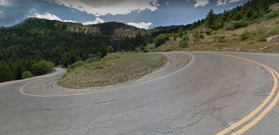
The road has lots of traffic and features hairpin turns and a narrow, rock shelf alignment in places. It’s heavily used by truckers because it’s by far the most expeditious route north from Grand Junction. The narrow lanes, heavy use, and erosion make for unexpected surprises. It is built into a shale mountainside that causes frequent lane blockages and erosion of the shoulders. The drive includes steep sections: on the southern side, hitting a 7% maximum gradient through some of the ramps. It’s one of the steepest paved mountain passes in Colorado.
Starting at the pass, a small unpaved road climbs up steeply to a communication tower, at 2,688m (8,818ft) above sea level. The climb is wild via three sharp hairpin turns. 4WD vehicle recommended.