Driving the legendary Rubicon Trail in California is a lifetime experience
Rubicon Trail is one of the most famous jeep trails and off-road adventures in the western United States, crossing through El Dorado National Forest in the Sierra Nevada Mountains.

Where is the Rubicon Trail?
The trail straddles Placer and El Dorado counties in the High Sierra of the U.S. state of California. Originally a stagecoach road through the high Sierra Mountains, from the Sacramento Valley to Lake Tahoe, the route has been used by 4-wheel drive vehicles since the early 1950s and has become one of the most famed 4-wheel drive trails in the world.
How tough is the Rubicon Trail?
It’s one of the most famous trails in California and features some of the most technical and beautiful off-road experiences in the country. Some of the Rubicon Trail’s more famous obstacles are Post Pile, Walker Hill, Little Sluice, Spider Lake, Old Sluice Box, Chappie Rock, Buck Island Dam, and Big Sluice. Other notable places include Loon Lake, Ellis Creek, Soup Bowl, Thousand Dollar Hill, Miller Lake, Uncle Tom’s Cabin, Granite Bowl, Rubicon Springs, Syd’s Grave, and Cadillac Hill. Cadillac Hill is very steep, tippy, and potentially dangerous.
Is the Rubicon Trail dangerous?
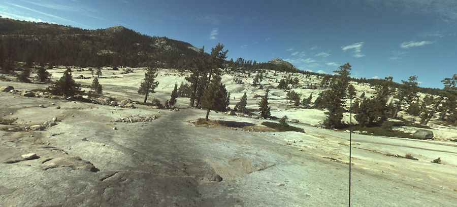
During wet periods, one water crossing can be very deep and muddy. It’s a rare combination of difficulty, beauty, length, and pure rock-crawling pleasure. The surface of the trail is a mix of granite slabs, soft dirt, sharp rocks, and large boulders that require precise maneuvering to avoid body damage. Several extreme sections can be bypassed, but many very rough sections cannot. The trail can become very dangerous. It is for experienced off-roaders only, but it’s destined to be one of the most memorable off-road adventures you’ll experience.
Why is the Rubicon Trail so famous?
This legendary trail in California is 35 km (22 miles) long, running from Georgetown to Lake Tahoe. It comprises Wentworth Springs Road and McKinney Rubicon Springs Road. It’s said to be the place where jeeping and off-roading began.
Is there cell service on the Rubicon Trail?
This trail passes through remote areas, so you need to be prepared. There is little to no cell service on the trail.
What's the weather like on the legendary Rubicon Trail?
The trail tops out at 2,134m (7,001ft) above sea level and is partially snow-covered in the winter. When traveling in the mountains, prepare for sudden changes in the weather. Always carry a roadside emergency kit and chains. The trail is only physically 8 to 10 feet wide. The Rubicon Trail travels through the El Dorado and Tahoe National Forests and is often under fire restrictions, even if the trail and its surroundings seem wet. Thunder and lightning storms may occur in the spring and summer months. The daily temperatures are changeable. Be prepared for snow and ice storms in the Fall and Winter months. The trail is challenging; it’s constantly changing.
Pic: Neil Tocher