Road trip guide: Conquering the Clay Butte Lookout in Wyoming
Clay Butte Lookout is a forest fire lookout at an elevation of 2,996m (9,829ft) above sea level, located in Park County, in the U.S. state of Wyoming.

Where is the Clay Butte Lookout?
The lookout is located in the northwestern part of Wyoming, within the Shoshone National Forest.
When was the Clay Butte Lookout built?
Once a working fire tower, the Clay Butte Fire Tower is now a visitor center, offering spectacular views of the Beartooth and Absaroka Mountain ranges. The Clay Butte Lookout was built in 1942 by the Civilian Conservation Corps and was used as a fire lookout until the 1960s. There is a gate 0.25 miles (0.4 km) from the lookout. The fire tower provides a stunning view of Montana’s Beartooth, Bighorn, and Absaroka Mountains. The 360-degree view from the tower is one you will long remember. Glimpse lofty peaks, emerald valleys, and sparkling lakes not seen from the main highway.
When was the road to Clay Butte Lookout built?
The access road to the lookout was completed in 1941.
Is the road to Clay Butte Lookout unpaved?
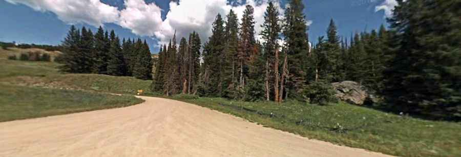
The road to the summit is totally unpaved. It’s called Forest Road 142 (FR142). This side trip up gravel road starts at the turnoff from the Beartooth Highway. It’s a dirt and gravel one-lane road, not suitable for trailers, RVs, or tour buses, but parking for trailers is available at Beartooth Lake, a few miles beyond the lookout. The road is in quite good condition, though there is some washboard, and is passable by low-clearance vehicles. Most cars should be fine. The road also leads hikers to the Upper Granite Loop trail.
Is the road to Clay Butte Lookout open in winter?
Set high in the northern Absaroka Range, accessibility is largely limited to the summer season. It is not generally snow-free until late June or even July in some years. Snow and freezing temperatures occur even in the summer months. Be careful for snowplows and icy road conditions. Afternoon thundershowers also pose threats from lightning.
How long is the road to Clay Butte Lookout?
The road to the summit is pretty steep. Starting from the paved Beartooth Highway, the ascent is 4.18 km (2.6 miles) long. Over this distance, the elevation gain is 253 meters. The average gradient is 6.05%.