The Ultimate Road Trip on the Joe Brown Highway
Joe Brown Highway is a mountain road deeply located in the wilderness, straddling western North Carolina and eastern Tennessee, in the USA.
How long is Joe Brown Highway?
Joe Brown Highway (Unicoi Turnpike) is 65km (40.1 miles) long, running north-south from Tellico Plains (a town in Monroe County, Tennessee) to Murphy (the county seat of Cherokee County, North Carolina).
Is Joe Brown Highway paved?
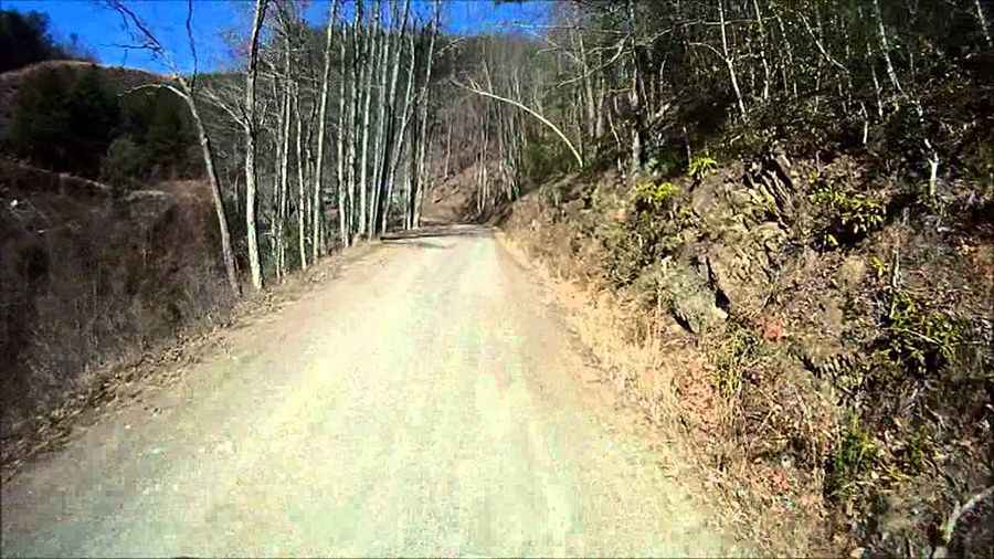
The road is mostly paved (20 miles of turns) and 10 miles of good dirt road.
Is Joe Brown Highway challenging?
The road can be traveled by car but is not recommended for buses and tractor-trailers. Travel advisory-narrow, winding unpaved road ahead. No turn-arounds. The road tops out at 626m (2,053ft) above sea level by Unicoi Gap.
How long does it take to drive the Joe Brown Highway?
Plan 2 hours to complete the drive without any stop but be sure to pull over every now and then to take pictures. There’s no cell signal for much of the way. It more or less follows the path of the Unicoi Turnpike, a trading route between Cowee Town (now Murphy) of the Middle Cherokee and the Cherokee town of Tellico in Tennessee.
Pic&video: chainsawbob Nichols