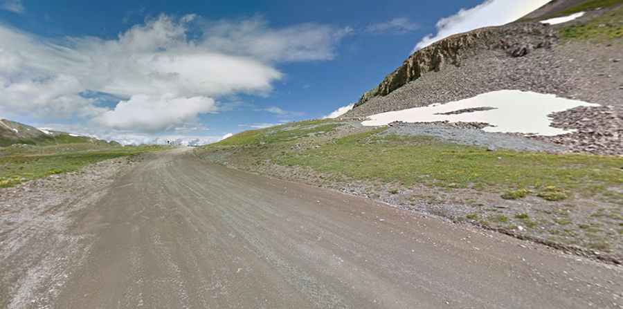
A rocky, rough and washed out road to Stony Pass in Colorado
Stony Pass is a high mountain pass at an elevation of 3.846m (12,618ft) above sea level, located in San Juan County, in the U.S. state of Colorado. It's one of the highest roads in Colorado.

Where is Stony Pass?
The pass is located east of Silverton, in the southwestern part of Colorado.
When was Stony Pass built?
The road was built in 1872 as a stage and freight route and a major supply line for the mining claims in the area. It was originally designed for pack animals and later graduated to accommodating wagons. The pass is also the route of the mule trains that brought miners, silver, and gold to and from Silverton, Colorado during the early mining days in the late 19th century. It was abandoned for a long time until the Forest Service reopened it in the 1950s.
Why is it called Stony Pass?
The pass got its name because of the rocky terrain.
Can I drive through Stony Pass Colorado?
The road to the summit, also known as Hamilton Pass, is totally unpaved. It’s called Stony Pass Road (Forest Road 520 and County Road 3).
How long is Stony Pass Colorado?
The road is 16.73km (10.4 miles) long, running from County Road 4 to Forest Road 506.
Is Stony Pass Colorado Open?
Set high in the San Juan Mountains, the road through the pass is not plowed in winters. It’s usually impassable from late October through late June or early July (depending on snow).
Is the road to Stony Pass in Colorado difficult?
The road to the summit is fairly rocky, rough, and washed out in parts. It follows the Rio Grande for many miles. High clearance, 4WD, and off-road vehicles are required. The road is pretty narrow in parts: there’s one spot where you hope you don't meet someone coming from the other way, as it is down to a one-lane width at that place.
Is Stony Pass worth it?
The summit offers panoramic views of the Continental Divide. The drive is very scenic, with lots of wildflowers, small creeks, waterfalls and enough mining history to make for a great adventure.