Enjoy a road among the clouds to Cameron Pass in Colorado
Cameron Pass is a high mountain pass at an elevation of 3.137m (10,291ft) above sea level, located in the US state of Colorado.
Where is Cameron Pass?
The pass is located on the boundary between Jackson County and Larimer County, in the north central part of Colorado.
Why is it called Cameron Pass?
The pass was named after Robert Cameron, the founder of the Fort Collins Agricultural Colony in the 1870s.
Is Cameron Pass in CO paved?
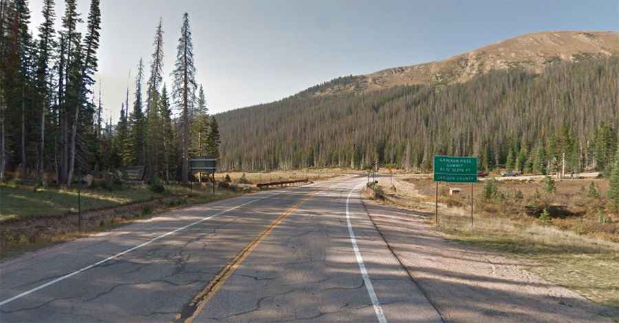
The road to the summit is totally paved. It’s called State Highway 14 (Poudre Canyon Road).
How long is Cameron Pass in CO?
The pass is 141.94km (88.2 miles) long, running west-east from the Town of Walden (the county seat of Jackson County) to Ted's Place, a gas station in Larimer County.
Is Cameron Pass steep?
The ascent up to the pass is relatively easy and gradual, however it hits a 12% of maximum gradient through some of the ramps. It has a mild approach from the east, and is steep from the west. There is plenty of parking on both sides of the summit. The area has a rich history of use throughout early mining activity in Colorado.
Is Cameron Pass in Colorado open?
Set high in the Rocky Mountains of the western United States, the road is well maintained and typically open all year round, but short term closures are common in winter due to dangerous weather conditions. The pass receives much snow during the winter months and is prone to avalanches. Snow can persist on the pass into late July or August.