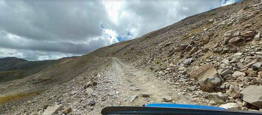
Mosquito Pass in Colorado is the highway of the frozen death
Mosquito Pass is a high mountain pass at an elevation of 4,026m (13,208ft) above sea level, located on the boundary between Lake and Park counties in the U.S. state of Colorado. Drive at your own risk. It's one of the highest roads in Colorado.

Where is Mosquito Pass?
The pass is located in the central part of Colorado, high in the Mosquito Range within the Pike National Forest.
How long is the road to Mosquito Pass in Colorado?
The road to the summit is totally unpaved. It’s 29km (18 miles) long, running east-west from Colorado Highway 9 near Alma over to the town of Leadville. It’s called Mosquito Pass Road (County Road 12) and County Road 3. It's nicknamed 'the highway of the frozen death' because of extremely dangerous patches of ice. An old mining road, north of the pass, climbs up to Mosquito Peak at 4,165m (13,664ft) above sea level.
Is the road to Mosquito Pass difficult?
The road is challenging. It is a two-way road, although it is tight in some spots and may require careful maneuvering to pass oncoming traffic. The journey requires a challenging route full of steep grades and scary narrow cliff faces. It is a very rough, narrow unpaved route. Among steep cliffs with stunning views, there are multiple stream crossings and portions with challenging terrain. It’s for experienced drivers with proper vehicles only. Drive at your own risk.
What vehicle do I need to complete the road through Mosquito Pass?
The route requires a high-clearance 4WD vehicle, good off-road driving skills, and steely nerves for those narrow ledges and airy drop-offs. 2WD vehicles should not attempt to traverse Mosquito Pass due to the stream crossings and high rocky sections.
How long does it take to drive Mosquito Pass?
Allow two to three hours to complete the drive. The pass had a rich history long before any modern road was established. You won't be traveling fast - 3 to 8 miles per hour once you head up the pass, and you'll spend a lot of time in low gears. There are no outhouses along this route. Before you head up over the pass, fill up with gas and use the facilities.
When was the road through Mosquito Pass built?
The first path over the pass was built in the 1870s as a toll road. Construction of the road began in 1949. There is a memorial to Father Dyer at the summit of the pass.
Why is it called Mosquito Pass?
About the origin of the Mosquito Pass name, there are lots of versions. One of the most popular says that just after nearby Montgomery was founded, gold was discovered high in the mountains above and gave rise to the town of Mosquito. The name came from a town meeting where a mosquito was crushed between pages of a book during the meeting. It was the only name they could agree on.
Is Mosquito Pass Colorado Open?
The road is open from July through September each year, depending on snowfall. Rain can make the road muddy and slippery, and snow can fall there any day of the year.
Is the road to Mosquito Pass remote?
Proper preparation is essential to having a safe, enjoyable trip on this road. Pack extra layers for the summit, which is often windy and cold. Due to the remoteness of the area, take special care to ensure that your vehicle is ready for the trip: inspect all tires and make sure they are properly inflated, check all vehicle fluids, replace worn hoses and belts, empty your RV's holding tank and fill the water tank, purchase groceries and supplies. For the vehicle, bring at least two full-sized spare tires mounted on rims, a tire jack, and tools for flat tires, emergency flares, extra gasoline, motor oil, wiper fluid, and a radio.
Is the road to Mosquito Pass steep?
The road to the summit is very steep.
East side:
Starting at Highway 9, near Alma, the ascent is 15.77km (9.8 miles) long via Mosquito Pass Road (County Road 12). Over this distance the elevation gain is 891 meters. The average gradient is 5.64%.
West side
Starting at the City of Leadville, the ascent is 12.55 km (7.8 miles) long via County Road 3. Over this distance the elevation gain is 879 meters. The average gradient is 7.0%.
Pic: John Carter