How to Get by Car to Tecate Peak in California?
Tecate Peak is a mountain with an elevation of 1,185m (3,887ft) above sea level, located in southeastern San Diego County, in the US state of California.

Where is Tecate Peak?
The peak is situated in the southern part of California, near the Mexican border, overlooking the Mexican city of Tecate.
What’s at the Summit of Tecate Peak?
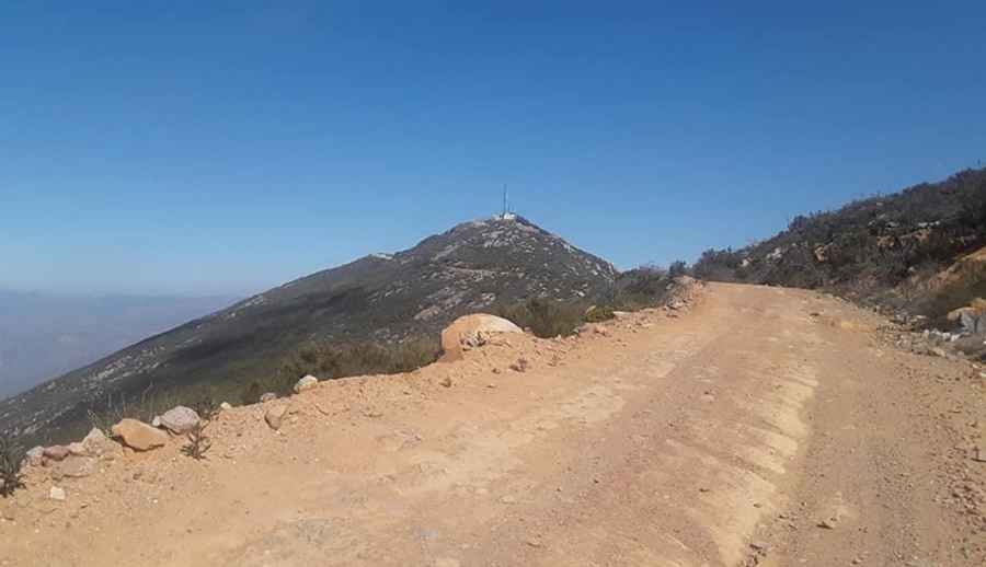
The summit hosts communication towers and facilities. A lookout atop the mountain served the area for at least 40 years before being demolished sometime after 1975.
Why is Tecate Peak Important?
Tecate Peak, originally referred to by the indigenous Kumeyaay People as Kuuchamaa, Kuchamaa, Cuchuma, and Cuchama, holds deep cultural and historical significance. The Kumeyaay, Native Americans from northern Baja California and Southern California, have considered it a sacred place for hundreds of years.
How Should I Drive to Tecate Peak?
The road to the summit runs close to the border, paralleling it for about a mile, sometimes within 50 feet of the actual boundary. The border is marked by a sequence of corrugated metal slabs. Be mindful of border patrol vehicles.
Is the Road to Tecate Peak Unpaved?
The road is mostly unpaved with some concrete sections. While it’s generally easy to drive, you’ll need to be cautious due to steep drop-offs, loose rocks, and ruts, especially after rain. The lower part of the road is gravel with ruts. Though there are small rocks and some chunky sections, they are not particularly difficult. Expect tight switchbacks, curves, and areas with exposure and steep drop-offs.
Can I Drive My Vehicle to Tecate Peak?
The road is maintained by border patrol, but a high-clearance vehicle is required. A 4-wheel drive vehicle is recommended for the summit drive.
How Long is the Road to Tecate Peak?
Starting from the paved CA-94 Road, the road to the summit is 10.46km (6.5 miles) long. Over this distance, there is an elevation gain of 747m, with an average gradient of 7.14%.
Pic: Dan Askar