Highway 111 hugs the mountains and connects Palm Springs to the rest of the valley
State Route 111 (SR 111) is a significant state highway in the US state of California, spanning from Calexico in the south to Whitewater near Palm Springs in the north. It serves as a crucial north-south route through the Coachella Valley and Imperial Valley.
Route Description
Starting at Imperial Avenue and 1st Street in Calexico, SR 111 originally led directly to the Calexico West Port of Entry before a 2018 realignment shifted traffic to Cesar Chavez Boulevard. The highway intersects with SR 98 in Calexico, then heads north through Heber and El Centro, where it intersects Interstate 8. Continuing north, it passes through agricultural areas including Holtville, Brawley, Calipatria, and Niland.
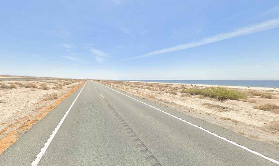
Salton Sea Section
A notable stretch of SR 111 runs along the eastern shore of the Salton Sea for approximately 40 miles. This area, marked by date and citrus groves, as well as small settlements and a state park, provides a unique but often desolate landscape due to the sea's water quality issues. On the western side of the lake, the road is called California State Route 86 (CA-86 S). It’s 75.63km (47.0 miles) long, running north-south from Coachella, in Coachella Valley, to Elmore Desert Ranch. The road was built in 1964.
What’s the Salton Sea?
The Salton Sea is a large, shallow, saline lake in southeastern California's Coachella and Imperial Valleys. It formed accidentally between 1905 and 1907 when the Colorado River breached a canal, flooding the Salton Sink—a low-lying desert basin. Covering approximately 343 square miles (890 square kilometers), it is California's largest lake by surface area but relatively shallow, averaging about 30 feet (9 meters) deep. The Salton Sea is saltier than the Pacific Ocean and has become an important habitat for birds along the Pacific Flyway, supporting over 400 bird species and fish adapted to its saline conditions. However, the lake faces challenges such as decreasing water levels, rising salinity due to agricultural runoff and evaporation, and occasional algae blooms. These issues threaten its ecosystem health and wildlife habitat. Local communities rely on the lake for recreation, though concerns over its environmental condition have impacted its popularity. Efforts to address these ecological problems continue, but finding sustainable solutions remains a challenge.
Coachella Valley Section
Entering the Coachella Valley, SR 111 transitions into a two-lane highway before expanding into a major arterial road. It passes through communities such as Indio, La Quinta, Indian Wells, Palm Desert, Rancho Mirage, and Cathedral City, serving as a key route for local and tourist traffic alike.
Palm Springs Section
Within Palm Springs, SR 111 bypasses downtown via a divided expressway configuration, culminating at its northern terminus at Interstate 10 near Whitewater. The highway's design and route through this area reflect its role as a vital transportation artery.
System Designations
SR 111 is integral to California's Freeway and Expressway System, with segments south of SR 78 and within Indio designated as part of the National Highway System. Despite its scenic potential, SR 111 has yet to receive official recognition as a State Scenic Highway by the California Department of Transportation.
Road suggested by: Marcus Smith