A wild unpaved road to Table Rock Lookout in Oregon
Table Rock is a summit at an elevation of 2,375m (7,791ft) above sea level, located in Baker County, in the U.S. state of Oregon.
Where is Table Rock in Oregon?
The summit is located in the eastern part of Oregon, at the southern tip of the Wallowa-Whitman National Forest.
Why is Table Rock in Oregon famous?
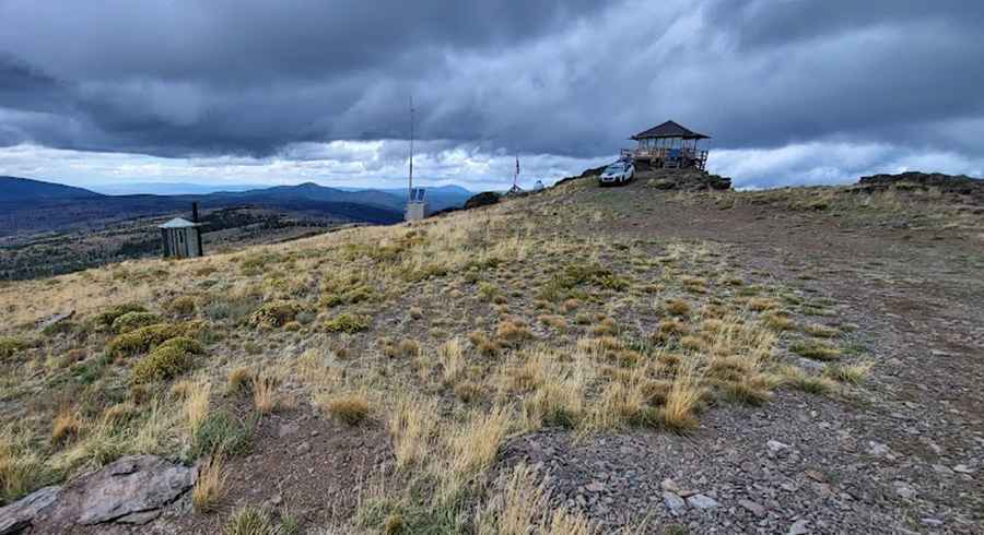
Located in the Monument Rock Wilderness, the summit hosts a fire lookout tower. Still in active service, this historic 1937 cabin replaced the original 1920s structure.
Can you drive to Table Rock Lookout in Oregon?
The road to the summit is entirely unpaved. It’s called NF-1370. A 4x4 vehicle is required to complete the drive. If your vehicle can't clear rocks/ruts that are 10+ inches, you will bottom out on the various washouts along the road. It’s usually impassable from November through March due to the snow.
How long is the road to Table Rock Lookout in Oregon?
Starting from Elk Flat Campground, the road to the summit is 7.40km (4.6 miles) long. Over this distance, the elevation gain is 388m (1,273 ft). The average gradient is 5.24%.
Pic: Carl Callow