Driving to Mount Disappointment: A Road through California's Missile Legacy
Mount Disappointment is a high mountain peak at an elevation of 1,797m (5,895ft) above sea level, located in Los Angeles County, in the US state of California.

Where is Mount Disappointment?
The peak is approximately an hour away from Los Angeles, situated in the southern part of California, within the southern fold of the San Gabriel Mountains.
Why is it called Mount Disappointment?
In 1894, USGS surveyors from the Wheeler Survey named it "Disappointment." Initially believed to be the highest point in the area, they planned to use it as their triangulation point. Upon reaching the summit, their anticipation turned into disappointment as they found San Gabriel Peak, half a mile (0.8 km) to the east, to be 167 feet (51 m) higher. Consequently, they shifted their focus to San Gabriel Peak.
Why is Mount Disappointment famous?
The road to the summit was constructed in the 1950s to build a missile site at the summit, which was flattened to accommodate it. The military knocked 50 feet off the top to make room for a Nike missile site during the Cold War. Now, there are telecommunications towers and antennas.
Can you drive to Mount Disappointment?
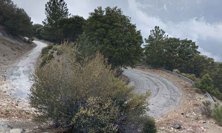
The road to the summit is entirely paved in pretty bad conditions. It’s called Mount Disappointment Road. It features countless curves and hairpin turns. It's closed to private vehicles, blocked by a gate.
How long is the road to Mount Disappointment?
Starting at the paved Mt. Wilson Red Box Road, the road to the summit is 4.98km (3.1 miles) long. It’s a pretty steep drive. The elevation gain is 366 meters, and the average gradient is 7.34%.
Is Mount Disappointment worth it?
Tucked away in the Angeles National Forest, the road winds through groves of pines and offers stunning views. At the summit, you can explore the missile pad and rock outcropping on the western face. It offers 360-degree views of the entire city of Los Angeles all the way to the ocean.
Pic: Andriy Daniluk