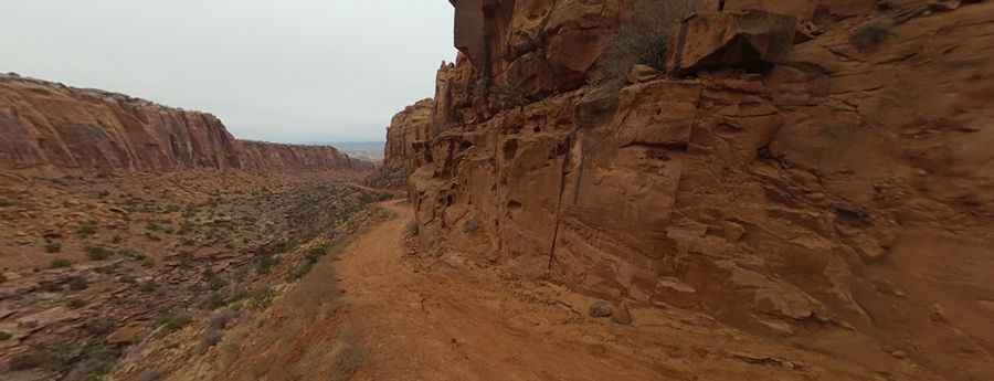
Driving the Steep Unpaved Road to Pucker Pass in Utah
Pucker Pass is a high mountain pass at an elevation of 1,783m (5,849ft) above sea level, located in Grand County, in the US state of Utah. The road to the summit is truly dangerous. High-clearance 4WDs are recommended, though any high-clearance vehicle can manage the drive.

Where is Pucker Pass?
The pass lies in the eastern part of Utah, within the Sky District of Canyonlands National Park, just north of Moab. Expect outstanding views from top to bottom, with incredible vistas of Long Canyon and the La Sal Mountains.
Why is it Called Pucker Pass?
It was named Pucker Pass by imaginative Jeepers back in the day when driving down the canyon was a far more nerve-wracking experience than it is today.
Is Pucker Pass Unpaved?
The road to the summit is completely unpaved and is known as Long Canyon Road. Expect a rough surface with possible mud and sand, though they are generally easily passable. Uphill traffic has the right of way, but not everyone follows this rule, so exercise common sense and caution when passing other vehicles. Be prepared for rocks up to 6 inches in diameter, a loose road surface, and shelf roads, though these are wide enough for passing or have adequate pull-offs.
How Challenging is the Road to Pucker Pass?
Most of the trail is relatively smooth, but you will encounter a few bumpy sections, particularly as you go through the pass where the road becomes both narrow and steep. While it’s generally a wide gravel road, the section through Pucker Pass can get tight. Under normal conditions, this route is suitable for stock 4WD vehicles, except after heavy rain when damage can make it more difficult.
How Long is the Road to Pucker Pass?
The drive is fairly steep. Starting from UT-279, the ascent stretches 6.9km (4.3 miles) with an elevation gain of 577 meters. The road has an average gradient of 8.36%.
When is the Best Time to Drive Pucker Pass?
The road is open year-round, weather permitting. Avoid traveling during severe weather conditions, and it’s best to drive when the road is dry. After heavy rainstorms, conditions can become more challenging.
Pic: John Carter