Tassajara Road in California is a very challenging ride through mountain terrain
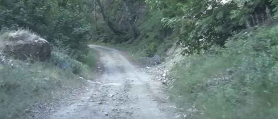
Tassajara Road is a mountain road located on the Pacific coast of the U.S. state of California, with one-lane corners and deep ruts in the road at various times of the year.
Where is Tassajara Road?
The road is located in Monterey County, in the western part of California, within Los Padres National Forest.
How long is Tassajara Road?
It’s 27.51 km (17.1 miles) long, running north-south from East Carmel Valley Road towards Tassajara Hot Springs, a collection of natural hot springs in the Ventana Wilderness, within the Carmel Valley.
How challenging is Tassajara Road?
The road is totally unpaved and a very challenging ride. The road winds its way through mountain terrain. It peaks around 5,000 ft, and the last few miles descending into Tassajara can be rougher than the first part of the road. 4-wheel drive and high-clearance vehicles only. A manual transmission is recommended. The condition of the road can change rapidly depending on the weather. There are no guardrails. Don’t try to drive it at night. Go slow around corners and pay attention. Cellular service is unreliable. This route may be impassable during winter months.
How to get by car to Oliver Observing Station (MIRA)?
A short (0.7 miles long) road, east of Tassajara Road, climbs up to Oliver Observing Station (MIRA), at an elevation of 1,524 m (5,000 ft) above sea level. The site has world-class qualities for optical astronomical observations.
Pic&video: Tassajara Zen Mountain Center