What are the most spectacular roads in the USA?
Located in North America, the USA is a true paradise for drivers, as it hosts more than 2,000 roads listed as the most spectacular in the world.
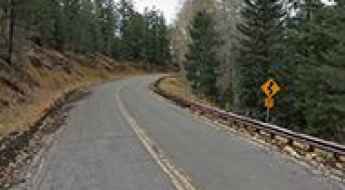
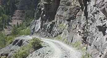
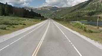
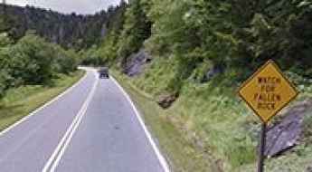
Featuring mountains, deserts, coasts, and snow, in the USA you’ll get your dream road. And you’ll never want to wake up. For instance, at the top of your list, you need to drive the Million Dollar Highway, the most beautiful road in America, and probably in the world. Built in the late 1880s, you'll be on the "outside" for a while with a hell of a view to your right (let the passenger enjoy the view; you'll want to watch the road). Another paved option must be the Iron Mountain Road, featuring 17 miles, 314 curves, 14 switchbacks, 3 pigtails, and 3 tunnels in the Black Hills of South Dakota. No list would be complete without the winding Tail of the Dragon: 318 curves in 11 miles. Spanning Tennessee and North Carolina, it is one of the most scenic drives in the USA. You also can’t skip driving Mount Evans Scenic Byway, the highest paved road in North America, climbing up to 4,310m (14,130ft) in Colorado. It is said to be the highest paved road in North America.
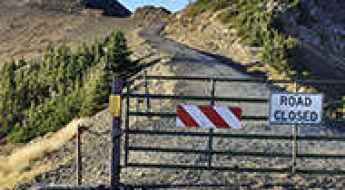
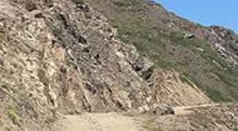
For those who prefer unpaved experiences, the country hosts some of the most defiant yet scenic roads in the world. You can’t miss Black Bear Pass, a high mountain adventure in the Colorado Rockies. Climbing up to 3,915m (12,844ft) above sea level, it's one of the highest roads in Colorado. You can also discover the beauty of Engineer Pass, a mountain pass at an elevation of 3,901m (12,800ft) above sea level in Colorado. It’s mostly a first-gear ride because the road is rough and rocky. The legendary Shafer Trail Road in Utah's Canyonlands National Park is an iconic drive located on the east-central edge of Utah. At times, the road is so narrow that only one car can pass. And Lippincott Mine Road in California is for experienced 4WD drivers using high-clearance vehicles only. You'll need a good map, as the routes are not marked and there are no signs. It’s one of the challenging backcountry roads in Death Valley National Park.
Ultimate 4wd destination: Clear Lake in San Juan NF
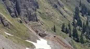
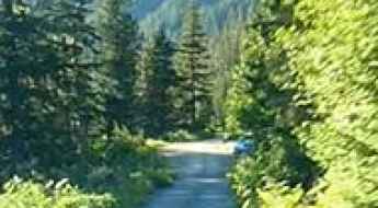
Clear Lake is an alpine turquoise lake at an elevation of 3.653m (11,984ft) above sea level, located in San Juan County, in the U.S. state of Colorado. Be sure to have experience in back roads if you attempt this trail. The drive is not for the faint of heart.
What are the highest roads in Idaho?
Located in the northwestern region of the United States, Idaho contains hundreds of individual mountain ranges an unspoiled beauty. It has the most rugged terrain in the country, with 114 named mountain ranges and fifty mountain peaks having an elevation of 10,000 feet above sea level. Literally covered from north to south by the Rocky Mountains, the State is known for its mountainous landscapes and vast swaths of protected wilderness and outdoor recreation areas.
The Best RV Routes Through The Smoky Mountains (Must See!)
With around 187,000 acres of land, the Great Smoky Mountains are a major attraction of the USA that thousands of people flock to every year. This large area of land stretches along the Tennessee-North Carolina border.
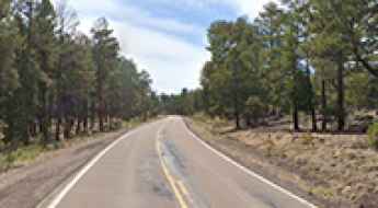
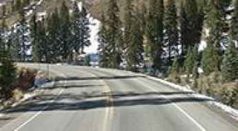
Driving the scenic Arizona State Route 260
Arizona State Route 260 is a very scenic high mountain road located in the north-central part of the U.S. state of Arizona.
Old Maverick Road is the easiest off-road road in Big Bend NP
Old Maverick Road is a scenic desert back road located in Brewster County, in the U.S. state of Texas. It’s said to be the easiest off-road route in Big Bend National Park.
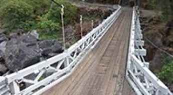
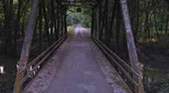
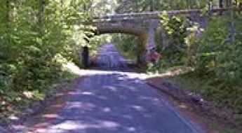
The iconic Mosquito Bridge in California
Located in El Dorado County, in the U.S. state of California, Mosquito Bridge is one of the most spectacular bridges in the world.
The remote Kleinschmidt Grade Road in Idaho will test your nerves
Located in Adams County, in the US state of Idaho, Kleinschmidt Grade Road (Forest Road 050) will test your nerves. It is recommended that beginner riders avoid this road. Keep your eyes on the road, not the scenery.
A paved road to Targhee Pass in the Henrys Lake Mountains
Targhee Pass is a high mountain pass at an elevation of 2.161m (7,089ft) above sea level, located on the border between Idaho and Montana, in the USA.
What are the highest roads in Washington?
Located in the Pacific Northwest region of the United States, Washington is the 18th largest state. Lying at the northwestern corner of the 48 conterminous states, it’s bordered by Canada in the north and Oregon in the south. On the east, it’s bordered by Idaho and, on the west, it’s bordered by the Pacific Ocean.
A paved road to the top of Whiteface Mountain in New York
Whiteface Mountain is a high mountain peak at an elevation of 1,402m (4,599ft) above sea level, located in Essex County, in the U.S. state of New York. At this elevation it's said to be the highest paved road in NY.

Vermont Street is the curviest street of San Francisco
Located in the Potrero Hill district of San Francisco, in the US state of California, Vermont Street is said to be the crookedest street in the United States. Hold on to the steering wheel and get ready for a series of hairpin turns on a stretch of roadway that few travelers and locals know about.
How to get by car to High Rock Bay in Michigan's Keweenaw Peninsula?
High Rock Bay is a very scenic spot located in northeastern Keweenaw County in the U.S. state of Michigan. A variety of vehicles try to make it out to the end, but most will turn around. The road can be rough if there has been rain and it hasn't been graded.
Cadillac Summit Road, a trip to the highest point on the east coast of the USA
Cadillac Mountain is a mountain peak at an elevation of 457m (1,499ft) above sea level located on Mount Desert Island, in Hancock County, in the US state of Maine. It is the highest point on the east coast of the U.S.
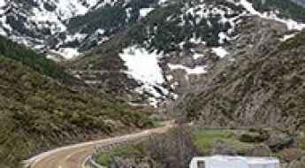
Cascade River Road in Washington is not suitable for large RVs
Cascade River Road is a picturesque mountain route situated in Skagit County, in the U.S. state of Washington.

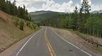
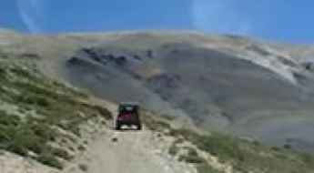
A scenic unpaved road to Buffalo Pass in Colorado
Buffalo Pass is a high mountain pass at an elevation of 3,146m (10,321ft) above sea level, located in the U.S. state of Colorado. It is suitable for most SUVs and some passenger cars with careful tire placement in spots.
Canton Avenue is one of the steepest streets in the USA
Canton Avenue is a little street tucked into a corner of Beechview neighborhood of Pittsburgh, in the US state of Pennsylvania. It’s said to be one of the steepest streets in the United States, with a maximum gradient of 33 percent.
Chinook Pass is a premier drive in Washington
Chinook Pass is a high mountain pass at an elevation of 1.655m (5,430ft) above sea level, located in Yakima County, in the U.S. state of Washington.
Travel guide to Corkscrew Pass in Colorado
Corkscrew Pass is a high mountain pass at an elevation of 3,732m (12,244ft) above sea level, located in San Juan County, in the US state of Colorado. The road is suitable only for 4-wheel-drive vehicles. It’s narrow and steep on some switchbacks. It’s one of the highest roads in Colorado.
Travel guide to the top of Coal Bank Pass in Colorado
Coal Bank Pass is a high mountain pass at an elevation of 3.243m (10,640ft) above sea level, located in San Juan County, in the U.S. state of Colorado.
O'Neil Pass is the highest paved road of South Dakota
O'Neil Pass is a mountain pass at an elevation of 2,046m (6,712ft) above sea level, located in Lawrence County, in the U.S. state of South Dakota. It’s said to be the highest paved road of South Dakota.
Bobcat Pass is a high mountain road in New Mexico
Bobcat Pass is a high mountain pass at an elevation of 2,995m (9,826ft) above sea level, located in Carson National Forest, in the U.S. state of New Mexico.
Red Grade Road is a beautiful drive with lots of wildlife in Wyoming
Red Grade Road is a very treacherous drive located in Sheridan County, in the US state of Wyoming. It is rough and steep and requires a suitable vehicle.
Arizona Snowbowl is one of the highest roads of Arizona
Arizona Snowbowl is a ski resort at an elevation of 2.912m (9,553ft) above sea level, located in Coconino County, Arizona. It's one of the highest roads in Arizona.
Norris Canyon Road is a scenic drive in Yellowstone NP
Norris Canyon Road is a highly scenic route in the heart of Yellowstone National Park, in the U.S. state of Wyoming. It runs entirely over 2,300m (7,500ft) above sea level.
The steep Tuna Canyon Road is one of the 7 Best Driving Roads in Malibu
Tuna Canyon Road is a very scenic yet demanding drive located in western Los Angeles County, in the U.S. state of California. It’s said to be one of the 7 Best Driving Roads in Malibu. The road is very steep (up to 18%). It’s one of the Top Scenic Drives in Malibu.
Last Dollar Pass is one of Colorado's best back-country roads
Last Dollar Pass is a high mountain pass at an elevation of 3.254m (10,676ft) above sea level, located in San Miguel County, in the U.S. state of Colorado. It’s said to be one of Colorado's best backcountry roads.
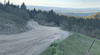
How to get by car to Tomboy ghost town in Colorado?
Located in San Miguel County in the U.S. state of Colorado, at an elevation of 3.482m (11,423ft) above sea level, Tomboy ghost town is an old mining town from the 1880s that used to host 1,000 year-round residents. The mine closed in 1927, and the town ceased to exist, though work in the mine tunnel continued until 1978.
A narrow dirt road with steep drop offs to Francis Peak in Utah
Francis Peak is a high mountain peak at an elevation of 2.887m (9,471ft) above sea level, located in the U.S. state of Utah. Most cars can make this bumpy journey, though it is a back-country road.
Antelope Canyon Road in Arizona is pure adventure
Located in the U.S. state of Arizona, Antelope Canyon Road is the access road to the most-visited and most-photographed slot canyon in the American Southwest. The road is actually a riverbed.
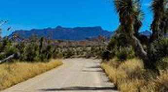
Old Dale Road is an old mining road in Joshua Tree NP
Old Dale Road is a scenic drive located in Joshua Tree National Park, in the US state of California. This old mining road traverses the eastern portion of the park from north to south It’s one of the famous backcountry roads in the Joshua Tree National Park.
Travel guide to Fremont Pass in Colorado
Fremont Pass is a high mountain pass at an elevation of 3.455m (11,335ft) above sea level, located in the U.S. state of Colorado.
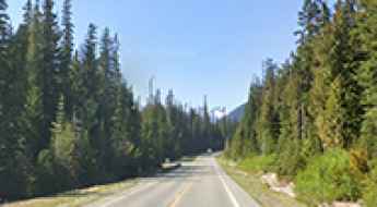
North Cascades Highway is one of Washington's Ultimate Road Trips
North Cascades Highway (State Route 20) is a very scenic drive located in North Cascades National Park, in the US state of Washington. The road is part of the Cascade Loop, a 436-mile (702 km) driving tour through the Cascades in the northern areas of Washington.
Molas Pass is a challenging climb on the Million Dollar Highway
Molas Pass is a high mountain pass at an elevation of 3.328m (10,918ft) above sea level, located in San Juan County, in the U.S. state of Colorado.
The haunted Witches Bridge in Illinois
Located west of Clarksdale, in Christian County, Illinois, in USA, Witches Bridge is one of the most spectacular bridges in the world.
Driving to Clingmans Dome, the Highest Point in the Smokies
Clingmans Dome is a high mountain peak at an elevation of 2,025m (6,643ft) above sea level, located on the border between Tennessee and North Carolina, in the southeastern United States.
Driving the haunted Crawford Road in Virginia
Crawford Road is said to be one of the most haunted roads in the US state of Virginia, a source of local haunting lore for decades. Many people have reported hearing the ghostly sounds of a battle as well as sighting spectral soldiers in the area.
An Explorer's Guide to Boriana Mine in Arizona
Boriana Mine is an abandoned tungsten mine at an elevation of 1,711m (5,613ft) above sea level located in Mohave County, in the US state of Arizona. High clearance and four-wheel drive vehicles only.
Driving to Crown King, a mining town in Arizona
Crown King is a high mountain mining town at an elevation of 1,765m (5,790ft) above sea level, located in Yavapai County, in the US state of Arizona. Much of the road to the town uses an old railroad bed running across the desert, over gold mines, and through the forest.
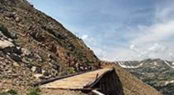
The closed road to Devil’s Slide Trestles in Colorado
Devil’s Slide Trestles is a narrow-gauge unstable railroad located in Boulder County, in the U.S. state of Colorado. It was built to allow the defunct Denver & Salt Lake Railroad to cross the Continental Divide via Rollins Pass.
What are the highest roads in Oregon?
Located in the Pacific Northwest region on the West Coast of the United States, Oregon is a state divided by mountains. It’s bounded to the north by Washington state; to the east by Idaho; to the south by Nevada and California; and to the west by the Pacific Ocean. Oregon is one of the most geographically diverse states in the U.S. It is most known for its diverse landscape that includes a rugged coastline, mountains, dense forests, valleys, high desert and large cities.
An old mining road to Mount Patterson in California
Mount Patterson is a high mountain peak at an elevation of 3,560m (11,679ft) above sea level, located in Mono County, in the U.S. state of California. It’s one of the highest roads in California.
Frying Pan Road is an awe-inspiring route through White River NF
Frying Pan Road is a very scenic uphill drive located in the U.S. state of Colorado. The road runs entirely above 2,000m (6,500ft) above sea level.
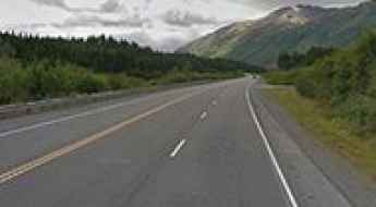
Seward Highway is an awe-inspiring route in Alaska
Seward Highway is a very scenic drive located in the U.S. state of Alaska. The drive is full of amazing scenery. Every direction is gorgeous and interesting.
Top of the World is one of the gnarliest roads of Moab
Top of the World is a natural viewpoint at an elevation of 2,149m (7,050ft) above sea level, located in Moab, Grand County, in the U.S. state of Utah. At the top, you are treated to one killer view from a 3,000-foot cliff overlook. It features one of the most scenic drives and best views in Moab—or perhaps all of Utah.

Jones Pass in Colorado may be intimidating to novice drivers
Jones Pass is a high mountain pass at an elevation of 3.804m (12,480ft) above sea level, located in the U.S. state of Colorado. The road to the summit has a relatively good road surface given its high altitude. It's one of the highest roads of Colorado.
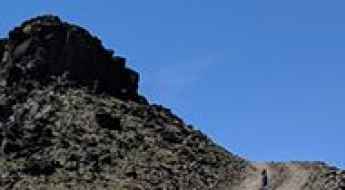
Potosi Mountain is one of the gnarliest roads of Nevada
Potosi Mountain is a high mountain peak at an elevation of 2,580m (8,464ft) above sea level, located in Clark County, in the US state of Nevada.
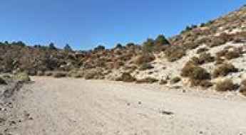
Mengel Pass in California: Only Experienced Drivers with Advanced Off Road Skills
Mengel Pass is a mountain pass at an elevation of 1.314m (4,311ft) above sea level located in Inyo County, in the US state of California. Famous for the site where Charles Manson was captured by police, it is a favorite Jeep trail in Death Valley. Rough 4WD vehicle needed.
Hunter Mountain is a Most Tricky Scenic Drive in Death Valley NP
Hunter Mountain is a high mountain pass at an elevation of 2,185m (7,168ft) above sea level located in Inyo County, in the US state of California. It’s one of the challenging Backcountry roads in Death Valley National Park.