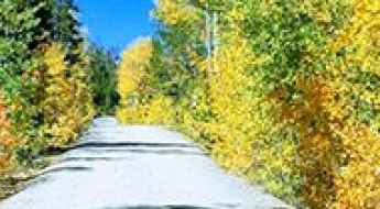
What are the most spectacular roads in the USA?
Located in North America, the USA is a true paradise for drivers, as it hosts more than 2,000 roads listed as the most spectacular in the world.
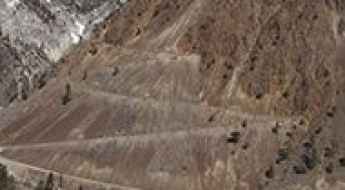
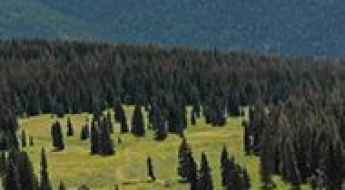
Featuring mountains, deserts, coasts, and snow, in the USA you’ll get your dream road. And you’ll never want to wake up. For instance, at the top of your list, you need to drive the Million Dollar Highway, the most beautiful road in America, and probably in the world. Built in the late 1880s, you'll be on the "outside" for a while with a hell of a view to your right (let the passenger enjoy the view; you'll want to watch the road). Another paved option must be the Iron Mountain Road, featuring 17 miles, 314 curves, 14 switchbacks, 3 pigtails, and 3 tunnels in the Black Hills of South Dakota. No list would be complete without the winding Tail of the Dragon: 318 curves in 11 miles. Spanning Tennessee and North Carolina, it is one of the most scenic drives in the USA. You also can’t skip driving Mount Evans Scenic Byway, the highest paved road in North America, climbing up to 4,310m (14,130ft) in Colorado. It is said to be the highest paved road in North America.
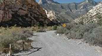
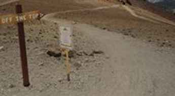
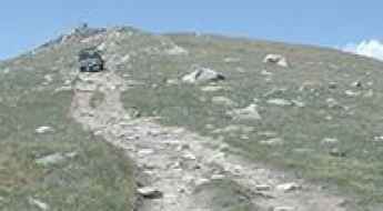
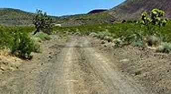
For those who prefer unpaved experiences, the country hosts some of the most defiant yet scenic roads in the world. You can’t miss Black Bear Pass, a high mountain adventure in the Colorado Rockies. Climbing up to 3,915m (12,844ft) above sea level, it's one of the highest roads in Colorado. You can also discover the beauty of Engineer Pass, a mountain pass at an elevation of 3,901m (12,800ft) above sea level in Colorado. It’s mostly a first-gear ride because the road is rough and rocky. The legendary Shafer Trail Road in Utah's Canyonlands National Park is an iconic drive located on the east-central edge of Utah. At times, the road is so narrow that only one car can pass. And Lippincott Mine Road in California is for experienced 4WD drivers using high-clearance vehicles only. You'll need a good map, as the routes are not marked and there are no signs. It’s one of the challenging backcountry roads in Death Valley National Park.
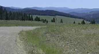
Drive the dusty yet scenic Cathedral Valley Driving Loop Tour in Utah
Cathedral Valley Driving Loop Tour is a very scenic drive located in Wayne County, in the US state of Utah. It is usually accessible to most cars with high clearance but 4WD is recommended. It’s one of the best drives in Capitol Reef National Park.
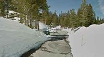
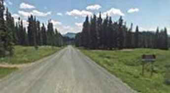
The road to Thompson Pass, the snowiest place in Alaska
Thompson Pass is a mountain pass at an elevation of 841m (2,759ft) above sea level, located in Valdez–Cordova Census Area, in the US state of Alaska.
The Wild Road to Jelm Mountain in Wyoming
Jelm Mountain is a high mountain peak at an elevation of 2.948m (9,671ft) above sea level located in Albany County, in the US state of Wyoming.
Phon D Sutton Trail in Arizona is an Adventure Track You Will Never Forget
Phon D Sutton Trail is a very scenic road located in Maricopa County, in the U.S. state of Arizona.
Road trip guide: Conquering Bountiful Peak in Utah
Bountiful Peak is a high mountain peak at an elevation of 2.787m (9,143ft) above sea level, located in Davis County, in the U.S. state of Utah.
A hairy scenic road to Steptoe Butte in Washington
Steptoe Butte is an isolated hill at an elevation of 1.101m (3,612ft) above sea level, located in Whitman County, in the US state of Washington.
A memorable road trip to Mount Brigham in Utah
Mount Brigham is a high mountain peak at an elevation of 3.559m (11,676ft) above sea level located in Piute County, in the US state of Utah. It’s one of the highest roads in Utah.
Discovering the scenic Geology Tour Road in Joshua Tree NP
The Geology Tour Road is a very scenic drive located in Riverside County, in the U.S. state of California. The road leads through one of Joshua Tree National Park's most fascinating landscapes, where the forces of erosion, earthquakes and ancient volcanoes have played out in stunning splendor.
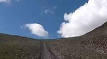
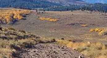
A steep unpaved road to the summit of Peavine Peak in Nevada
Peavine Peak is a high mountain peak at an elevation of 2.517m (8,257ft) above sea level, located in Washoe County, in the U.S. state of Nevada.
How to get by car to Alma, the highest town in North America?
Located in Park County, in the US state of Colorado, Alma is the highest incorporated town in North America at an elevation of 3.224m (10,578ft) above sea level. It’s one of the highest towns on Earth accessible by car.
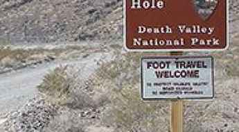
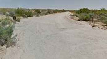
The unpaved road to Devil’s Hole in Nevada
Devil’s Hole is a subaqueous cavern, located in Nye County, in the US state of Nevada, with an eerie legend.
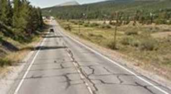
A Scenic Paved Road to Luther Pass in California
Luther Pass is a high mountain pass at an elevation of 2,364 m (7,755 ft) above sea level, located in the U.S. state of California.
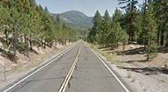
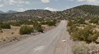
A gravel road to the historic Mullan Pass in Montana
Mullan Pass is a high mountain pass at an elevation of 1,799 m (5,902 ft) above sea level, located on the boundary between Powell and Lewis and Clark counties in the US state of Montana.
Conquering the Pinkham Canyon-Thermal Canyon Road in California
The Pinkham Canyon-Thermal Canyon Road is a very scenic drive located in Riverside County, in the US state of California. It’s one of the most famous backcountry roads in the Joshua Tree National Park.

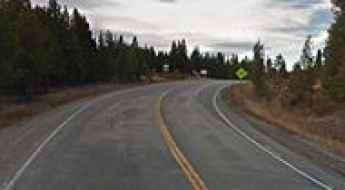
The most dangerous intersection in every US state
Every state has at least one intersection that plays host to more accidents and close calls than all the rest. Time Magazine looked at data from the National Highway Traffic Safety Administration to determine the most dangerous intersection in each US state.
A narrow unpaved road to Devil Mountain in Colorado
Devil Mountain is a high mountain peak at an elevation of 3,026 m (9,927 ft) above sea level, located in Archuleta County, in the U.S. state of Colorado.
How To Travel The 31 Mile Road in New Mexico
31 Mile Road is a scenic mountain drive located on the boundary between Rio Arriba and Sandoval counties, in the US state of New Mexico. It’s one of the highest roads in New Mexico.
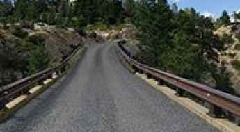
Crossing the Hell's Backbone Bridge of Utah
Located in Garfield County, in southern Utah, in the USA, Hell's Backbone Bridge is one of the most spectacular bridges in the world.

Miles Glacier Bridge is the bridge to nowhere in Alaska
The Miles Glacier Bridge, completed in the early 1900s, spans the Copper River in Alaska and is notable for its multiple-span Pennsylvania truss design. Built to facilitate a 196-mile railroad line for the Copper River and Northwestern Railway, the bridge was essential for transporting copper from the mining town of Kennicott to the port of Cordova. It is considered one of the most spectacular bridges in the world.
Exploring the 8 Deadliest Roads in California
Driving through the deep gorges to the beautiful roads of the coastline, through the densely populated areas to the abominable gauntlet taking you to Sin City. There are several roads, which need extra caution while driving through the Golden State.
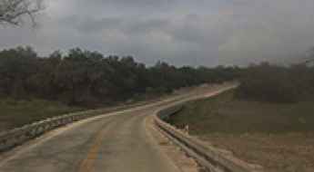
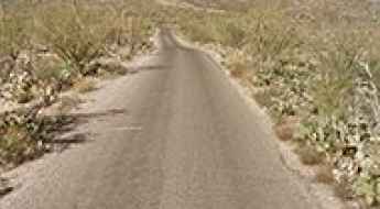
Driving the floodable Rebecca Creek Road in Texas
Rebecca Creek Road is a short paved road located on the Edwards Plateau in the U.S. state of Texas. The road features a river crossing which floods during storm season.
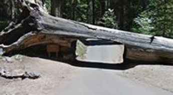
Crescent Meadow Road in California: Where You Can Drive Through a Giant Tree
Crescent Meadow Road is a paved narrow mountain road located in Tulare County, in the U.S. state of California.
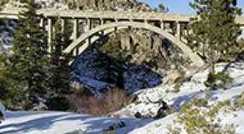
The iconic Donner Summit Bridge in California
Located in Nevada County, in the US state of Califnornia, Donner Summit Bridge is one of the most spectacular bridges in the world.
How to Drive the Rocky Gap Road in Nevada
Rocky Gap Road is an extremely rugged backcountry road located in Clark County, in the U.S. state of Nevada. The road is rocky and rough in many areas where it has been washed out. The middle portion of the route can present some challenges.
The intimidating road to Mammoth Mountain in California
Mammoth Mountain is a high mountain peak at an elevation of 3.364m (11,036ft) above sea level, located in Madera County, in the U.S. state of California. It’s one of the highest roads in California.
The Wild Road to Ptarmigan Pass in the Sawatch Range of Colorado
Ptarmigan Pass is a high mountain pass at an elevation of 3.352m (11,777ft) above sea level, located on the boundary between Summit and Eagle counties in the US state of Colorado.
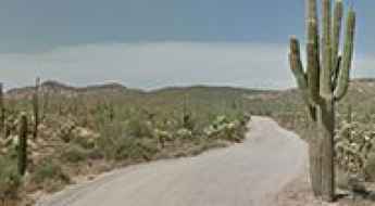
Cactus Forest Drive is a scenic road in Saguaro NP
Cactus Forest Scenic Loop Drive is a one-way paved loop road located in Pima County, in the US state of Arizona.
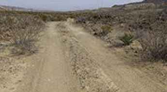
Primitive Dirt Roads in Big Bend National Park
Located in southwest Texas, on the U.S.-Mexico border, the Big Bend National Park is one of the most popular vacation destinations in the state. Scenic vistas, diverse wildlife, and historic siteswhere night skies are dark as coal and rivers carve temple-like canyons in ancient limestone. This remote park features rugged mountains, steep canyons, amazing views, unparalleled night skies, and solitude in a high desert setting.
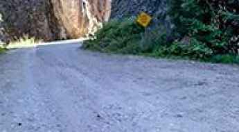
The Road to Hat Point is the Scariest Drive in Oregon
Hat Point is an overlook located in Wallowa County, in the U.S. state of Oregon, at an elevation of 2,130m (6,988ft) above sea level. This is a journey that some will never attempt again because it frightened them so much: there are steep drop-offs and a very narrow road.
Driving the Paved Road to Cuchara Pass in Colorado
Cuchara Pass is a high mountain pass at an elevation of 3,036m (9,960ft) above sea level, located in the US state of Colorado.
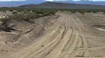
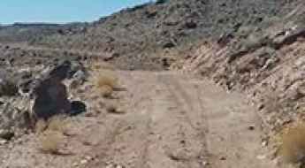
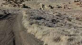
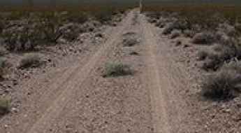
How to Travel the Owl Hole Spring Road in Death Valley NP
Owl Hole Spring Road is an exciting desert drive located in San Bernardino County, in the US state of California. It is one of the most remote locations in the park and one of the challenging backcountry roads in Death Valley National Park.
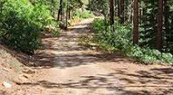
The Ultimate Guide to Traveling the South Willow Canyon Road in Utah
South Willow Canyon Road is a very scenic drive in Tooele County, in the US state of Utah. The road is mostly paved but becomes gravel at the National Forest boundary, and winds through some very interesting narrows.
An old mining road to Mount Morgan in California
Mount Morgan is a high mountain peak located in Inyo County, in the US state of California. A gravel road near the summit climbs up to 3.619m (11,873ft) above sea level. It’s one of the highest roads in California.
Hardscrabble Pass in Colorado is an absolute must for road lovers
Hardscrabble Pass is a high mountain pass at an elevation of 2.773m (9,097ft) above sea level, located in Custer County, in the U.S. state of Colorado.
Driving the iconic road to Minaret Summit in Sierra Nevada
Minaret Summit is a high mountain pass at an elevation of 2,824m (9,265ft) above sea level, located in the U.S. state of California. It's one of the highest roads in California.
A sensational road to Louis Lake in Wyoming
Louis Lake is a high mountain lake at an elevation of 2,617 m (8,585 ft) above sea level, located in Fremont County, in the U.S. state of Wyoming.
Ultimate 4WD Destination: Napoleon Pass in Colorado
Napoleon Pass is a high mountain pass at an elevation of 3,668m (12,034ft) above sea level, located in Gunnison County, in the U.S. state of Colorado, with multiple creek crossings. It’s one of the highest roads in Colorado.
A 5-star road to Tennessee Pass in Colorado
Tennessee Pass is a high mountain pass with an elevation of 3,183m (10,442ft) located in the U.S. state of Colorado.
Ultimate 4wd destination: Alpine Plateau in Colorado
Alpine Plateau is a high mountain plateau at an elevation of 3.516m (11,535ft) above sea level, located in Gunnison County, in the U.S. state of Colorado.
A very bumpy, grueling road to North Twin Cone Peak in Colorado
North Twin Cone Peak is a high mountain peak at an elevation of 3.759m (12,332ft) above sea level, located in Park County, in the U.S. state of Colorado. It’s one of the highest roads in Colorado.
Aiken Mine Road: Otherworldly Landscapes of Basalt Flows in California
Aiken Mine Road is an old mining track located in the Mojave Desert of the U.S. state of California. 4x4 vehicles are recommended.
Grayback Mountain is a truly outstanding 4x4 adventure in Colorado
Grayback Mountain is a high mountain peak with an elevation of 3,853 m (12,641 ft) above sea level, located in Rio Grande County, in the U.S. state of Colorado. It’s one of the highest roads in Colorado, offering great views of the surrounding mountains.
A road with lakes, mountains and meadows to Ripple Creek Pass in Colorado
Ripple Creek Pass is a high mountain pass at an elevation of 3,158 meters (10,360 feet) above sea level, located in Rio Blanco County, in the U.S. state of Colorado.
MacDonald Pass is a scenic drive through the Rocky Mountains in Montana
MacDonald Pass is a high mountain pass at an elevation of 1.930m (6,332ft) above sea level, located in the U.S. state of Montana.
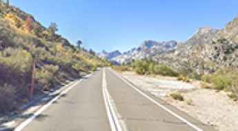
How to get by car to Lake Sabrina in California?
Lake Sabrina is a high mountain lake at an elevation of 2,796 m (9,173 ft) above sea level, located in Inyo County, in the U.S. state of California. It’s one of the highest roads in California.
Ultimate 4WD Destination: Leviathan Peak in California
Leviathan Peak is a high mountain peak with an elevation of 2,732m (8,963ft) above sea level, located in Alpine County, in the U.S. state of California. The views from the summit are impressively remote.
The Wild Road to Deadman Pass in Death Valley NP
Deadman Pass is a mountain pass at an elevation of 996 m (3,267 ft) above sea level, located in Inyo County, in the U.S. state of California. It’s one of the challenging Backcountry roads in Death Valley National Park.
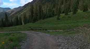
A memorable road trip to Velocity Basin in Colorado
Velocity Basin is a cirque basin with a small turquoise lake at its base, at an elevation of 3.449m (11,315ft) above sea level, located in San Juan County, in the U.S. state of Colorado.