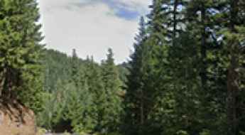
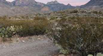
What are the most spectacular roads in the USA?
Located in North America, the USA is a true paradise for drivers, as it hosts more than 2,000 roads listed as the most spectacular in the world.
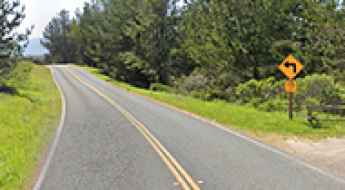
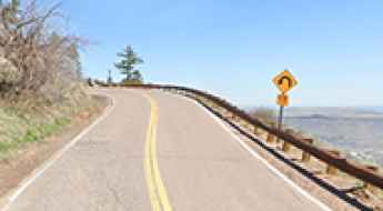
Featuring mountains, deserts, coasts, and snow, in the USA you’ll get your dream road. And you’ll never want to wake up. For instance, at the top of your list, you need to drive the Million Dollar Highway, the most beautiful road in America, and probably in the world. Built in the late 1880s, you'll be on the "outside" for a while with a hell of a view to your right (let the passenger enjoy the view; you'll want to watch the road). Another paved option must be the Iron Mountain Road, featuring 17 miles, 314 curves, 14 switchbacks, 3 pigtails, and 3 tunnels in the Black Hills of South Dakota. No list would be complete without the winding Tail of the Dragon: 318 curves in 11 miles. Spanning Tennessee and North Carolina, it is one of the most scenic drives in the USA. You also can’t skip driving Mount Evans Scenic Byway, the highest paved road in North America, climbing up to 4,310m (14,130ft) in Colorado. It is said to be the highest paved road in North America.
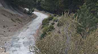
For those who prefer unpaved experiences, the country hosts some of the most defiant yet scenic roads in the world. You can’t miss Black Bear Pass, a high mountain adventure in the Colorado Rockies. Climbing up to 3,915m (12,844ft) above sea level, it's one of the highest roads in Colorado. You can also discover the beauty of Engineer Pass, a mountain pass at an elevation of 3,901m (12,800ft) above sea level in Colorado. It’s mostly a first-gear ride because the road is rough and rocky. The legendary Shafer Trail Road in Utah's Canyonlands National Park is an iconic drive located on the east-central edge of Utah. At times, the road is so narrow that only one car can pass. And Lippincott Mine Road in California is for experienced 4WD drivers using high-clearance vehicles only. You'll need a good map, as the routes are not marked and there are no signs. It’s one of the challenging backcountry roads in Death Valley National Park.

Foodie Road Trip: Must-Try Dishes Across the United States
Embarking on a foodie road trip across the United States is a culinary adventure like no other. From coast to coast, the diverse culinary landscape offers a tantalizing array of flavors, textures, and dishes that showcase the rich tapestry of American cuisine. In this guide, we'll take you on a gastronomic journey highlighting must-try dishes in different regions of the country, ensuring your taste buds are treated to an unforgettable experience.
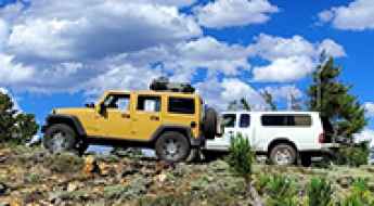
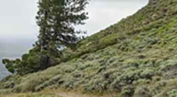
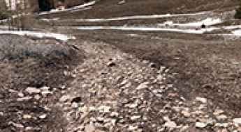
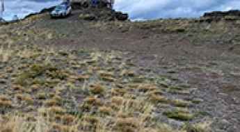
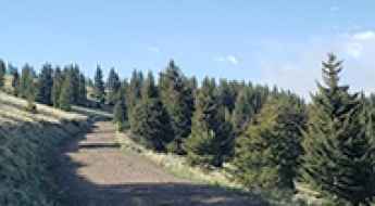
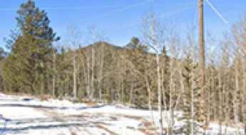
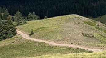
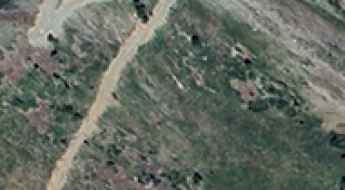
An old mine road to South Peak in Colorado
South Peak is a high mountain peak located in Lake County, in the U.S. state of Colorado. An old mining road, to the south of the summit, climbs up to 3,824m (12,545ft) above sea level. It's one of the highest roads in Colorado.

What To Do if You Are in a Rental Car Accident in the USA?
If you happen to be involved in a car accident while driving a rented vehicle, it can be quite overwhelming and distressing. Dealing with the aftermath of such an incident requires prompt action based on prior knowledge of safety guidelines and appropriate measures. Elaborated below are the two essential steps to take for anyone who happens to be in a rental car accident.

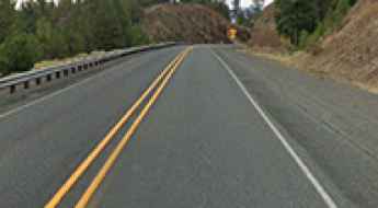
Understanding Liability After an Accident on Dangerous Highways in the USA
Facing up to the aftermath of a highway accident is no less challenging than the treacherous bends of the road itself. One minute, you're admiring nature's grandeur; the next finds you in a whirlwind of flashing lights and paperwork. It's critical to discern who's at fault amidst this chaos, which can be as complex as the landscape you were just enjoying.
How to get to Limantour Beach in California by car?
Limantour Beach is a sandy beach located between Drakes Bay and the Limantour Estero estuary, in Marin County, in the US state of California.
What are the most haunted roads of North Carolina?
Have you ever been told that certain roads are best traveled during daylight hours? Much of this belief stems from the numerous myths and legends surrounding the pavement. Whether these tales are myths, legends, or truths remains uncertain, but rumors suggest that these North Carolina roads have witnessed horrifying incidents leading to traffic accidents.

What are the highest roads in Texas?
Located in the southern part of the country, Texas has a diverse and large topography. It’s bordered by New Mexico, Oklahoma, Arkansas, and Louisiana, and also by the Gulf of Mexico. It’s the second-largest state after Alaska. It features a variety of geographical regions, including deserts, plains, forests, and mountains.

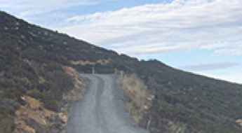
How to get by car to Pride of the West Tunnel in Colorado?
Pride of the West Mine is a high mountain gold mine at an elevation of 3,662 m (12,014 ft) above sea level, located in Chaffee County, in the U.S. state of Colorado. It’s one of the highest roads in Colorado.
Driving the Scenic Road to Lookout Mountain: Stunning Views of Denver and Buffalo Bill's Gravesite
Lookout Mountain is a high mountain peak at an elevation of 2,237m (7,339ft) above sea level, located in Jefferson County, in the US state of Colorado.
How to get by car to Yellow Mountain in California?
Yellow Mountain is a high mountain peak at an elevation of 2.465m (8,087ft) above sea level, located in Modoc County, in the U.S. state of California.
Driving to Mount Disappointment: A Road through California's Missile Legacy
Mount Disappointment is a high mountain peak at an elevation of 1,797m (5,895ft) above sea level, located in Los Angeles County, in the US state of California.

Choosing the Right Car Wrap Finish
Have you ever seen a car in a parking lot or speeding past you on the highway, flames blazing on both sides? Chances are, a professional car wrap service wrapped that car. The demand for custom car wrap designs is growing exponentially. In 2024, it will be one of the fastest-growing trends in the car customization industry.
The Ultimate Road Trip to Lundy Lake in California
Lundy Lake is a high mountain lake located in Mono County, in the U.S. state of California. The lake covers 100 acres and is 1 mile long and 1/2 mile wide.
Driving the steep 4x4 road to Swanholm Peak in Idaho
Swanholm Peak is a high mountain peak at an elevation of 2.662m (8,733ft) above sea level, located in Elmore County, in the U.S. state of Idaho. The road to the summit, on a very steep grade, is not for the faint of heart.
The wild 4x4 road to Hager Mountain in Oregon
Hager Mountain is a volcanic peak at an elevation of 2,191m (7,188ft) above sea level, located in Lake County, in the U.S. state of Oregon. The area is known for its scenic vistas and wild places.
Driving the challenging Sleeping Deer Road in Idaho
Sleeping Deer Road is a very challenging 4x4 road located in the center of the U.S. state of Idaho. It’s one of the highest roads in Idaho.
How To Have The Ultimate Road Trip To Pat Knoll in Arizona
Pat Knoll is a high mountain peak at an elevation of 2,859m (9,379ft) above sea level, located in Apache County, in the U.S. state of Arizona. It’s one of the highest roads in Arizona.
Roadkill hotspots around the world
There are millions of roads in the world. Many of these roads cut across rural or uninhabited areas where numerous domesticated and wild animals wander freely. In this article, we reveal some of the most vulnerable animals and accident hotspots in 10 selected countries (based on most cars per capita).
What You Need to Know About Driving Forest Road 4725 in San Juan County
Forest Road 4725 is a high mountain unpaved road located in San Juan County, in the US state of Utah.
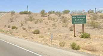
Driving the Paved I-40 to Mountain Springs Summit in California
Mountain Springs Summit is a mountain pass at an elevation of 844m (2,770ft) above sea level, located in San Bernardino County, in the U.S. state of California.
How to Drive the Historic Priest Pass in Montana
Priest Pass is a high mountain pass at an elevation of 1,832 m (6,010 ft) above sea level, located on the boundary between Powell and Lewis and Clark counties in the US state of Montana.
Usery Pass in Arizona is an absolute must for road lovers
Usery Pass is a mountain pass at an elevation of 647m (2,122ft) above sea level, located in Maricopa County, in the U.S. state of Arizona.
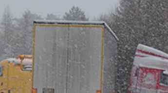
What are the Main Challenges Faced by a Truck Accident Victim?
Although the impacts of a truck accident are devastating, it is almost impossible to prevent them from happening. Cities like Las Vegas are prone to truck accidents. Due to their massive sizes, a collision between a truck and a car or a pedestrian can be catastrophic.
Driving the paved road to Long Creek Mountain Summit in Oregon
Long Creek Mountain Summit is a high mountain pass at an elevation of 1.551m (5,088ft) above sea level, located in Grant County, in the U.S. state of Oregon.
A wild unpaved road to Table Rock Lookout in Oregon
Table Rock is a summit at an elevation of 2,375m (7,791ft) above sea level, located in Baker County, in the U.S. state of Oregon.
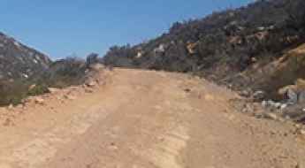
How to Get by Car to Otay Mountain in California?
Otay Mountain is a mountain an elevation of 1,087m (3,566ft) above sea level located in southeastern San Diego County, in the US state of California.
Tombstone Pass is an absolute must for road lovers in Oregon
Tombstone Pass is a mountain pass at an elevation of 1,294m (4,245ft) above sea level, located in Linn County, in the US state of Oregon.
Driving the Steep Pine Creek Road in Inyo County
Pine Creek Road is a challenging drive with steep sections and narrow parts, located in Inyo County, in the US state of California.
Take the Scenic CA-299 Road and Discover Cedar Pass in California
Cedar Pass is a high mountain pass at an elevation of 1,926 m (6,318 ft) above sea level, located in Modoc County, in the U.S. state of California.

How Many Points Is Careless Driving? A Comprehensive Guide
Careless driving is a common traffic violation, but many drivers don’t realize the impact it can have. It can lead to fines, higher insurance costs, and points on your license. But how many points do you get for careless driving?
Driving the Scenic Pine Canyon Road in Big Bend NP
Pine Canyon Road is a very scenic drive located in Brewster County, in the U.S. state of Texas, offering stunning views of the Chisos Mountains. A high-clearance vehicle is recommended, as some parts of the road can be rough.
Driving a Wild 4x4 Road to Mount Taylor in New Mexico
Mount Taylor is a dormant volcano at an elevation of 3,441m (11,289ft) above sea level, located in Cibola County, in the U.S. state of New Mexico. It’s one of the highest roads in New Mexico.
How to Get by Car to Tecate Peak in California?
Tecate Peak is a mountain with an elevation of 1,185m (3,887ft) above sea level, located in southeastern San Diego County, in the US state of California.
Driving the unpaved road to Brooks Mountain in Jeff Davis County
Brooks Mountain is a high mountain pass at an elevation of 2.185m (7,168ft) above sea level, located in Jeff Davis County, in the U.S. state of Texas. It's one of the highest roads in Texas.
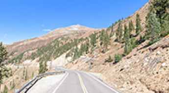
How to drive the Top of the Rockies National Scenic Byway
The Top of the Rockies National Scenic Byway is a designated National Scenic Byway and Colorado Scenic and Historic Byway located in the Rocky Mountains of Colorado. It spans approximately 115 miles (185 kilometers) through Lake, Eagle, Pitkin, and Summit Counties.
An Unforgettable Drive to Rhyolite Mountain in Teller County
Rhyolite Mountain is a high mountain peak at an elevation of 3,230 m (10,597 ft) above sea level, located in Teller County, in the U.S. state of Colorado.
Driving the Scenic Paved Road to Oldman Pass in Washington
Oldman Pass is a mountain pass with an elevation of 934m (3,064ft) above sea level, located in Skamania County, in the U.S. state of Washington.
How to get to Slide Lake in Colorado by car
Slide Lake is a high mountain lake at an elevation of 3,575m (11,729 ft) above sea level, located in Lake County, in the US state of Colorado.
What are the highest roads of Vermont?
Vermont, often called The Green Mountain State, is situated in the New England region of the northeastern United States. Its name comes from the French words mont and vert, translating to "green mountain." Vermont shares borders with Canada to the north, New Hampshire to the east, Massachusetts to the south, and New York to the west, and it remains one of the more sparsely populated states.
Driving the Rugged Juniper Canyon Road in Big Bend
Juniper Canyon Road is a scenic drive located in Brewster County, Texas, offering stunning views of the Chisos Mountains. The road is very rocky and rough, typically requiring a 4WD vehicle.
Everything You Need to Know About the Wild Road to Palo Encebado Peak in New Mexico
Palo Encebado Peak is a high mountain peak at an elevation of 3,069m (10,068ft) above sea level, located in Taos County, in the U.S. state of New Mexico. It’s one of the highest roads in New Mexico.
Driving the Wild Road to Cerro Pelon in the Manzano Mountains
Cerro Pelon is a high mountain peak at an elevation of 3,058m (10,032 ft) above sea level, located in Cibola County, in the U.S. state of New Mexico. It’s one of the highest roads in New Mexico.
How to get to the summit of Hershberger Mountain in Oregon
Hershberger Mountain is a high mountain peak at an elevation of 1,853m (6,079ft) above sea level, located in Douglas County, in the U.S. state of Oregon.
Driving the Wild 4x4 Road to Thurston Peak in Utah
Thurston Peak is a high mountain located in the U.S. state of Utah. A minor gravel road, north of the peak, climbs up to 2,990m (9,809ft) above sea level.
How To Travel The 4x4 Road to Centralia Mountain in Jefferson County
Centralia Mountain is a high mountain peak at an elevation of 2.876m (9,435ft) above sea level, located in Jefferson County, in the US state of Colorado.
Drive the Wild Horse Road Near Hanksville and Feel Like You’re on the Moon
Straddling Wayne and Emery counties, Wild Horse Canyon Road is a scenic dirt road that runs through the San Rafael Swell in the US state of Utah.
How to get by car to Smith Creek Lakes in Utah?
Smith Creek Lakes are three small glacial cirque lakes at an elevation of 2,722m (8,930ft) above sea level, located in Morgan County, in the U.S. state of Utah.

How to Get to Horsethief Lookout Tower by Car in Arizona
Located in Yavapai County, in the U.S. state of Arizona, Horsethief Lookout Tower sits at an elevation of 2,045m (6,709ft) above sea level.