How to drive the scenic Mexico 175 (Tuxtepec Road)?
The Tuxtepec road is said to be Mexico’s most scenic road. It offers everything you could wish for on a road trip: mountains, desert, pine forest, jungle, cactus, mountain lakes, lots of curves, scenic views, hairpin curves, rivers, and canyons... Except polar or ice environments, you can find it all here.

Departing from Oaxaca City at 1,600 meters above sea level (masl) (5,249 ft), the road first ascends in a series of sharp curves up to 2,730 masl (8,957 ft) in a mountain pass near Ixtepeji, then it descends to a canyon of Rio Grande near Gualatao de Juarez at 1,530 masl (5,022 ft). The road again ascends into the mountains of Sierra de Juárez (part of Sierra Madre del Sur) to a maximum elevation of 2,970 masl (9,744 ft) near Humo Chico mountain. From Humo Chico mountain, the road starts to descend near sea level in a series of endless curves. It’s not recommended for those who suffer from dizziness. It has great views of mountain flora, changing from pine forest to tropical jungle, at Tuxtepec (30 masl / 98 ft). There’s no project to bypass this road; however, if someday a highway project is planned for this area, it will definitely be one of the greatest engineering constructions of all time in Mexico and one of the most scenic highways in the world.
El Punto Pass
This pass is located near the small community of El Punto, at 2,750 meters above sea level (masl) (9,022 ft). Starting from Oaxaca City at 1,600 meters above sea level (5,249 ft), the road quickly ascends to 2,750 meters (9,022 ft) in just 18 kilometers, offering spectacular views of far Oaxaca City and the central valley. This road goes from the transition of the semi-arid region of Oaxaca City into the pine forest area at the top. Past the pass, the road descends into an arid canyon at 1,520 meters above sea level (5,019 ft).
Road to San Miguel del Río
A scenic road to San Miguel del Río, with 6 paved hairpin curves to access the town. The access area is located at 1,850 meters above sea level (6,070 ft), descending to the river at 1,460 meters above sea level (4,790 ft). The road has a dangerous steep grade and curves.
Sierra de Juárez
This is a popular tourist region due to the historic importance and natural beauty of the area. This is where Benito Juárez was born in the town of Guelatao de Juárez, after whom the president of Mexico, Benito Juárez García, was named. Starting from the bottom of the canyon at 1,520 meters above sea level (5,019 ft) of Rio Grande de Juárez, the road ascends to the area of Guelatao at 1,760 meters (5,774 ft) on average and continues gaining elevation at the next town at 2,000 meters (6,561 ft) at Ixtlán, continuing to 2,990 meters (9,809 ft) above sea level near Llano de Las Flores, another small community high in the mountains. Ixtlan de Juárez, Guelatao, and Capulálpan offer commodities for tourists, such as restaurants and hotels, as well as historical churches and museums about Benito Juárez. There are also natural bridges, caves, and waterfalls in the region. The road traverses a rich area of natural resources, with huge pine trees like ponderosas, long meadows, and a few canyon views.
Humo Chico Pass
This is a high mountain pass at an elevation of 2,970 meters above sea level (9,744 ft). It’s the highest point on this road route, Mexico 175. Exactly at the highest point, there is a newly built restaurant and an overview point for visitors, as well as some cabins.
Road to Humo Chico Mountain
The small dirt road to Humo Chico, starting near the pass of Humo Chico (Mexico 175) at 2,950 meters above sea level (9,678 ft), abruptly ascends into the mountain at a maximum elevation of 3,140 meters above sea level (10,302 ft), the highest accessible point by car in Oaxaca state. This road offers spectacular 360° views in all directions of the Sierra Madre Oriental mountains from the top of Humo Chico mountain at 3,230 meters above sea level (10,597 ft).
Road to Valle Nacional (Mexico 175)
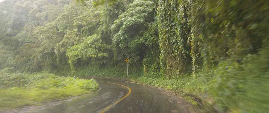
Starting from Humo Chico Pass at 2,970 meters above sea level (9,744 ft), the road gradually descends to 90 meters above sea level (295 ft) in Valle Nacional town. This segment can be prone to sudden floods and fog, which affect it all year round, and the road surface is often slippery, making it a difficult challenge to drive. The transition from pine forest to tropical rainforest makes this road segment interesting in nature. There are several species around the road, and waterfalls might be present all year round. Don’t expect great views of the mountains from the road due to the high density of flora, trees, and bushes that affect the views this road might offer. However, this road may be harsh for those who suffer from dizziness due to the high number of curves.
Road suggested by: Eblem Torres