Puchutla Road is not recommended if you suffer of dizziness
Mexico 175 (Puchutla Road) is a long, curvy and scenic drive. If you suffer of dizziness, this road is not recommended to you. Over 6 hours of constant movement with curves everywhere, small towns with speed bumps and scenic views of the Sierra Madre Mountains.
Mexico 175 (Puchutla Road) is a long, curvy and scenic drive. If you suffer of dizziness, this road is not recommended to you. Over 6 hours of constant movement with curves everywhere, small towns with speed bumps and scenic views of the Sierra Madre Mountains.
How dangerous is Puchutla Road?
This road is dangerous due high traffic volume in a so narrow road. It’s the main road between the capital Oaxaca to resort city of Huatulco. From Oaxaca city, the road it’s a “supercarretera” (two lanes wide highway) to Miahuatlán (1.570 masl). At this point the road starts to ascend the Sierra Madre del Sur mountains up to 2.770 masl near El Manzanal, offering stunning view of the mountains between pine forest in the area.
From Suchixtepec town at 2.580 masl, the road starts to descend to the sea level, by a road endless of curves and sharp turn, some which may need switchback, the road gets too narrow in some sections, where the incoming car must slow down or stop for safely pass. There’s no construction project to bypass this road, however the new highway between Puerto Escondido and Oaxaca (Mexico 131D), will be the best option to travel to Huatulco.
Lindavista
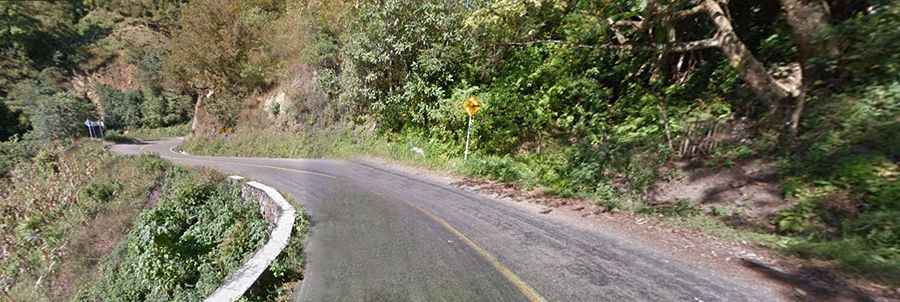
This segment is extremely windy and long, starting near from Puchutla at 150 meters above sea level, the road starts ascending into the mountains to an elevation of 2.560 meters above sea level in San Miguel Suchixtepec. This road offers the transition of tropical rain forest to oak trees and pine forest; it's very scenic.
San José del Pacífico Pass
This pass is located in the route between Oaxaca-Santa María Pochutla, at an elevation of 2780 meters above sea level. This area offers great views of the adjacent lower mountains, incrusted towns next to road and canyons and many pine trees, it's the most interesting area to drive on this segment between Oaxaca-Pochutla. San José El Pacífico or El Pacifico at 2.480 meters above sea level is a major tourist town in route, and one of the coldest towns in Oaxaca state. It offers many restaurants and hotels to visitors such as wood cabins, log houses, etc a popular destination to escape the hot areas of Oaxaca.
Miahuatán-San Andrés
Miahuatlán is a town at 1.660 meters above sea level. It’s the mouth of the south access to Oaxaca central valley, where many towns and state capital are located. The road offers some few hairpinned curves to the descend, offering a biome from pine forest near San Andres Paxtlan to a dry climate in Miahuatlán. In a short distance of just 12 kilometers the road goes from 2.400 meters above sea level to 1.660 meters.
Road suggested by: Eblem Torres