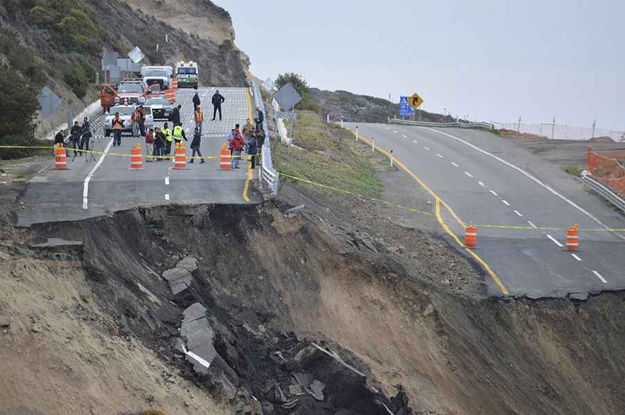
Travelling through the unstable Baja California Scenic Highway
Baja California Scenic Highway (Mexican Federal Highway 1D) is a very scenic toll road located in the northwestern Mexican state of Baja California.

How long is Baja California Scenic Highway?
This coastal road is 110km (68.35 miles) long. It’s fully paved and links Playas de Tijuana and Ensenada.
When was Baja California Scenic Highway built?
The highway was constructed in the mid-1960's. If you do have the opportunity to drive this highway use your better judgment, your experience and know your vehicle capability. It’s better to drive this highway during the day unless you're extremely comfortable driving at night with zero street lights.
Why is Baja California Scenic Highway famous?
In December, 2013 a series of small earthquakes and recent heavy rainfall caused a landslide that made the highway collapse in a 300 ft section at Kilometer 93, just north of Ensenada. The road has been considered unstable for years.
Road suggested by: Eblem Torres
Pic: https://kjzz.org/content/9404/ensenada-toll-road-collapse-affecting-tourism-baja-california