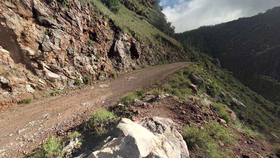
The road to Urique is not recommended due to security concerns
Urique is a small town located at the bottom of Urique Canyon, in the northern Mexican state of Chihuahua. The road to the town is extremely steep, unsurfaced, and rugged. It will test both vehicle and driver.

Urique is a small town located at the bottom of Urique Canyon, in the northern Mexican state of Chihuahua. The road to the town is extremely steep, unsurfaced, and rugged. It will test both vehicle and driver.
How challenging is the road to Urique?
The drive includes more than 100 turns and is not a viable option during the rainy season. According to locals, the road is in terrible condition, and the police do not recommend this route due to security concerns. The road descends around 2,000 meters in a series of switchbacks over fourteen kilometers. It is not a drive for the faint-hearted. Conditions vary depending on the weather, the time of year, and how recently the road has been maintained. It is a good idea to ask about road conditions before setting off.
How long is the road to Urique?
The gravel road to the town is about 54 kilometers long. The first 50 kilometers are relatively standard for a Mexican gravel road, but the last 14 kilometers are particularly treacherous, with a narrow road bordering a dangerous ravine. The road is barely wide enough for two cars to pass, there are no guardrails, and the curves are so severe that it is difficult to see if traffic is approaching from the opposite direction.
When was the road to Urique built?
Inaugurated in October 1975, this road tests the skill and courage of any driver. It is definitely not for anyone suffering from vertigo or a fear of landslides. The road is rough and extremely narrow, with just enough room for a car in many places. Due to the extreme drop-offs, drivers must pay very careful attention, but the biggest risk is encountering oncoming traffic with limited sight lines and very few places to pass. Only those who are exceptionally daring or paid to drive this route should attempt it.
Road suggested by: Eblem Torres
Pic: Markus scobdo