Driving the unpaved Bajada a Zirupa in Chihuahua
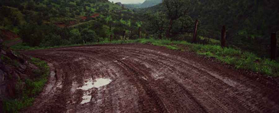
Bajada a Zirupa is a gravel mountain road located in the mountains of the Mexican state of Chihuahua.
How long is Bajada a Zirupa?
Located in the northwestern part of the country, the road is totally unpaved. It’s 29.5km (18.33 miles) long. It’s a very defiant drive after rains. A 4x4 vehicle is recommended.
Where does Bajada a Zirupa start and end?
The road runs north-south from the town of Madera, also known as Ciudad Madera, at an elevation of 2,200m above sea level, to Zirupa, also known as Sirupa, a small town at 1,492m above sea level.
Pic: Missael de la Rocha