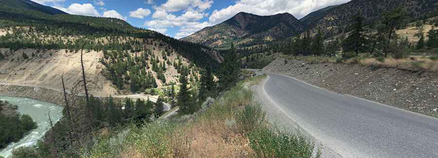
Highway 40 is a treacherous road in the heart of BC
Highway 40 is a delightful yet challenging drive located in the heart of British Columbia, Canada. The drive is suitable for all vehicles, but expect some narrow sections with 11%-13% grade switchbacks.

How long is Highway 40 in BC?
The road is 105km (65 miles) long, running from Lillooet (a small town encapsulated by breathtaking mountains and situated on the banks of the Fraser River) to Gold Bridge (in the Bridge River Valley). The sections as you go west are called the Moha Road, Bridge River Road, and Lillooet-Pioneer Roads (Road 40).
How challenging is Highway 40 in BC?
It’s a treacherous road, frequently narrow, with a multitude of tight radius 10-20kmh blind corners and steep drop-offs with no barriers. There is no cell phone signal for most of the road, and numerous large and small rocks can be found on the road. Expect some narrow sections with 11%-13% grade switchbacks.
Is Highway 40 in BC paved?
This narrow winding road is mostly paved with dust from passing vehicles on the gravel surface. It has been improved in recent years.
Can I drive my vehicle on Highway 40 in BC?
It’s suitable for all vehicles, but high clearance is highly recommended. The road is a crucial link frequented by locals, tourists, commercial truck drivers, and those from the forest and energy industries. It does get used by logging trucks and other industrial traffic, so watch out for that too, especially on particularly narrow stretches of the road.
Is Highway 40 in BC open?
It remains unmaintained during the winter season, and there’s no snowplowing on the road, regardless of the time of year. Rockslides are common, so always watch for falling rocks and wildlife. It features avalanche hazards in the winter season.
How long does it take to drive Highway 40 in BC?
To drive the road without stopping will take most people between 2.5 and 3 hours. The drive travels west through a variety of breathtaking scenery from the arid canyons near Lillooet, through the Bridge River Gorge, along turquoise Carpenter Lake, and finally ends deep in the Coast Mountains at the historic settlements of Gold Bridge. The drive is spectacular, with the colors and water levels of the Carpenter Lake Reservoir changing with the seasons. This route crosses spectacular mountain terrain featuring waterfalls and wildlife viewing.
Pic: Masha Prokopenko