What are the most spectacular roads in Canada?
Located in the northern part of North America, Canada -the second-largest country in the world- hosts many challenging drives, with more than 100 roads listed as the most spectacular worldwide. With mountains, lakes, rivers and coasts, the country has roads for every driver.
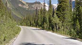
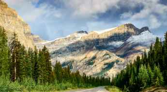
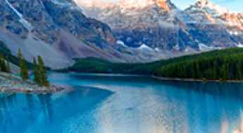
If you’re up for a scenic drive, the Icefields Parkway in the Canadian Rockies is a must do. Located in Alberta province, the road through big mountains, glaciers, and deep blue lakes is one of the most scenic drives in the world. But due to the geography of the country, you can tackle some challenging roads, such Coquihalla Highway, one of the worst roads in winter. In spring, summer, or fall, it's a breeze, but in winter, there are at least 400-500 accidents and plenty of fatalities.
If you’re up for a lifetime adventure, try the Trans-Labrador Highway, one of the world's most epic and remote road trips. Located in the province of Newfoundland and Labrador, most of the road features a well-packed asphalt/gravel surface, but along the route, drivers will experience sharp curves, winding parts, narrow bridges, and steep grades. And a very scenic yet difficult drive is the Bella Coola Road in British Columbia. It’s a 454-kilometer drive known for its steep grades and scenic views through a very diverse landscape.
Baldy Rocks
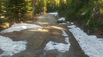
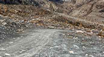
Baldy Rocks is a high mountain pass at an elevation of 1.975m (6,479ft) above the sea level, located in the Selkirk Mountains, British Columbia, in western Canada.
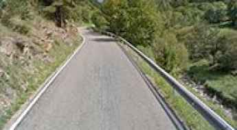
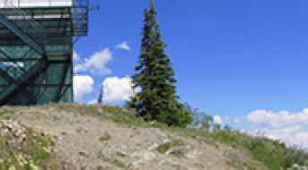
Things to Know Before Driving Emerald Lake Road in BC
Emerald Lake is a freshwater lake at an elevation of 1.310m (4,297ft) above the sea level, located in British Columbia, Canada's westernmost province.
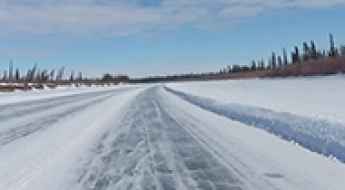
Driving the frozen Aklavik Ice Road in the Northwest Territories
Aklavik Ice Road is located in the Inuvik Region of the Northwest Territories, in Canada, over the frozen MacKenzie River and Arctic Ocean.
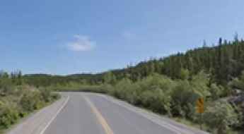
Driving the scenic Ingraham Trail in Yellowknife
Located in the Northwest Territories of Canada, the scenic Ingraham Trail is a road to adventure just out of Yellowknife, running to Tibbit Lake at the end of the trail.
Travel Guide to Tiara Peak
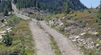
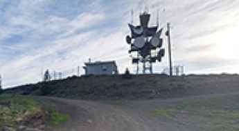
Tiara Peak is a high mountain peak located in the front ranges of Kananaskis Country, in the heart of Alberta, Canada. A minor gravel road, east of the summit, climbs up to 1.885m (6,184ft) above the sea level.
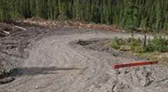
How to Survive and Journey through the Remote Nahanni Range Road
Nahanni Range Road is the name of a very remote drive that starts in the Yukon and ends in the Nortwest Territories of Canada. General public travel is not advised.
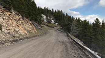
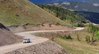
Take the Scenic Route and Discover Sinclair Pass in BC
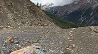
Sinclair Pass is a mountain pass at an elevation of 1.486m (4,875ft) above the sea level, located in British Columbia, Canada's westernmost province.
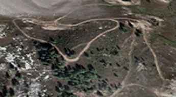
Take the Scenic Route and Discover Nancy Greene Summit in BC
Nancy Greene Summit is a high mountain pass at an elevation of 1.581m (5,187ft) above the sea level, located in British Columbia, Canada's westernmost province.
Top Canada Road Trips To Enjoy When On Vacation!
Your free time gives you room to consider several activities and going on a trip is one of them. It gets your juices flowing thinking about the different options that you can select from for your fun trip. One of these enjoyable locations is Canada, serving as a place filed with several amazing sights to make memories with people.

Adventure along the wild road to Little White Mountain in BC
Little White Mountain is a high mountain peak at an elevation of 2.142m (7,027ft) above the sea level, located in the south of Canada’s British Columbia province. It’s one of the highest roads of the country.
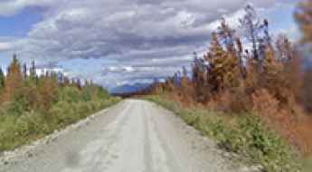
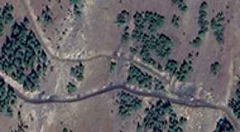
Route du Nord is a very remote road with little traffic in Quebec
Located in the James Bay territory, in the central part of Quebec, in Canada, Route du Nord (North Road) is a very defiant road not really intended for regular traffic.
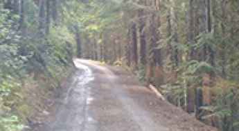
How To Have The Ultimate Road Trip To Levette Lake in BC
Levette Lake is a blue mountain lake through the trees located in Squamish-Lillooet Regional District, in the province of British Columbia, in Canada.
Take the Scenic Route and Discover White Pass in AK
White Pass is a mountain pass at an elevation of 1.010m (3,313ft) above sea level, located in the US state of Alaska, near the Canadian border.
Canada’s Open Roads: The Ultimate Guide to Thrilling Road Trips
When it comes to embarking on a road trip adventure, few countries offer the diversity and beauty that Canada does. With its vast landscapes, pristine wilderness, and well-maintained highways, Canada is a road-trippers paradise. We'll take you on a journey through some of the most awe-inspiring Canada’s open roads, sharing tips, insights, and must-visit destinations along the way.
CanAm Highway is a sensational drive from Mexico to Canada through the USA
The Canadian-American (CanAm) Highway is an international highway running south-north from Mexico to Canada through the United States.
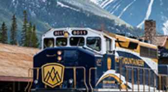
Rocky Mountaineer train trips: Luxurious way to experience Canada’s mountains
Train sightseeing has become a popular tourist activity for those who want to explore different parts of the world in a unique way. Among the world's most beautiful countries, Canada is one of the top contenders.
Exploring Canada by Train: A Journey of Scenic Beauty and Cultural Richness
Canada gives an exceptional opportunity for travelers to see its immense beauty in a relaxed and immersed way via rail. The country's vast landscapes extend from coast to coast. Travelling across Canada by rail is more than just a way to get around; it is an adventure that shows the nation's diversified scenery, fascinating history, and active culture.
Roadkill hotspots around the world
There are millions of roads in the world. Many of these roads cut across rural or uninhabited areas where numerous domesticated and wild animals wander freely. In this article, we reveal some of the most vulnerable animals and accident hotspots in 10 selected countries (based on most cars per capita).
A Wild 4x4 Road to Moose Mountain in Alberta
Moose Mountain is a high mountain peak at an elevation of 2,347 m (7,700 ft) above sea level, located in the province of Alberta, Canada. It’s one of the highest roads in the country.
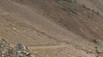
A challenging 4x4 trail to Watch Peak in BC
Watch Peak is a high mountain peak located in the province of British Columbia, Canada. A gravel road south of the summit climbs up to 2.403m (7,883ft) above sea level. It’s one of the highest roads in the country.

Driving the Wild 4x4 Road to the Lookout at Cornwall Hills in British Columbia
Cornwall Hills is a high mountain peak at an elevation of 2,037m (6,683ft) above sea level, located in the Canadian province of British Columbia. It’s one of the highest roads in the country.
How to Travel the Wild Road to Idaho Peak in British Columbia
Idaho Peak is a high mountain at an elevation of 2,121m (6,958ft) above sea level, located in British Columbia, Canada. It’s one of the highest roads in the country.
Everything you need to know about the wild road to Peak 09-48 in BC
Peak 09-48 is a high mountain peak at an elevation of 2,402 m (7,880 ft) above sea level, located in the Canadian province of British Columbia. It’s one of the highest roads in the country.
Driving to the Lookout at Mount Buchanan in BC
Mount Buchanan is a high mountain peak at an elevation of 1,910m (6,266ft) above sea level, located in the British Columbia province of Canada.
A Comprehensive Travel Guide to Hailstone Butte in Alberta
Hailstone Butte is a high mountain peak at an elevation of 2,326m (7,631ft) above sea level, located in the Alberta province of Canada. It’s one of the highest roads in the country.
Driving the wild 4x4 trail to Silver Mountain in BC
Silver Mountain is a high mountain peak at an elevation of 2.541m (8,336ft) above sea level, located in the province of British Columbia, Canada. It’s one of the highest roads in the country.
What You Need to Know About Driving the Wild Road to The Cleaver in BC
The Cleaver is a high mountain peak at an elevation of 2.262m (7,421ft) above sea level, located in the province of British Columbia, Canada. It’s one of the highest roads in the country.
A challenging 4x4 trail to Mount Slade in BC
Mount Slade is a high mountain peak located in the province of British Columbia, Canada. A gravel road east of the summit climbs up to 2,464 m (8,083 ft) above sea level. It’s one of the highest roads in the country.
A steep unpaved road to Whitehorn Mountain in AB
Whitehorn Mountain is a high mountain peak at an elevation of 2.525m (8,284ft) above sea level, located in the province of Alberta, Canada. It’s one of the highest roads in the country.
How to Get to the Lookout at Mount Lavina by Car?
Mount Lavina is a high mountain peak at an elevation of 2,246m (7,368ft) above sea level, located in British Columbia, Canada. It’s one of the highest roads in the country.
Driving the 4x4 Road to the Lookout at Greenstone Mountain in BC
Greenstone Mountain is a high mountain peak at an elevation of 1,798m (5,898ft) above sea level, located in the Canadian province of British Columbia.
How to Get to the Lookout at Eureka Mountain by Car
Eureka Mountain is a high peak reaching an elevation of 1,968m (6,456ft) above sea level, located in British Columbia, Canada.
Driving the Rough 4x4 Road to the Lookout at Mara Mountain in BC
Mara Mountain is a high peak with an elevation of 2,249m (7,378ft) above sea level, located in the province of British Columbia, Canada. It’s one of the highest roads in the country.
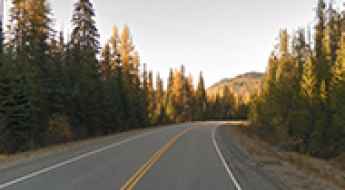
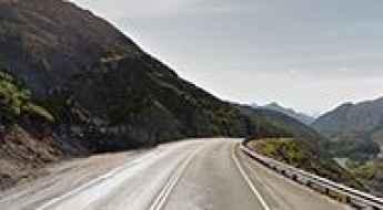
How to drive the scenic British Columbia Highway 93?
Highway 93 is a north-south route that runs through the southeastern part of British Columbia, connecting with U.S. Highway 93 at the Canada-U.S. border. It follows the Crowsnest Highway (Highway 3) and Highway 95, passing through Radium Hot Springs, and crosses the Continental Divide into Alberta at Vermilion Pass, where it continues as Alberta Highway 93.