Horseshoe Pass: Wales' Scenic Gem and the Drive of a Lifetime
Bwlch yr Oernant ("Pass of the Cold Stream") is a mountain pass at an elevation of 419m (1,374ft) above the sea level, located in the county of Denbighshire in Wales.
Bwlch yr Oernant ("Pass of the Cold Stream") is a mountain pass at an elevation of 419m (1,374ft) above the sea level, located in the county of Denbighshire in Wales.
When was the Horseshoe Pass built?
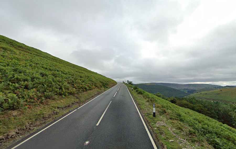
Situated in the northeast of Wales, the paved road leading to the summit is designated as A542. The establishment of this route can be traced back to 1811 when it was constructed as a turnpike road. Its unique name is likely derived from the horseshoe-like shape it embraces along the valley sides. Interestingly, in 2022, this road garnered the third spot in the UK's best summer road trips compilation.
Is the Horseshoe Pass open?
Nestled within the lofty Clwydian Range, the pass often faces winter closures due to threats of snowfall and landslides. Adventurous travelers should exercise caution during adverse weather conditions, particularly if journeying in a motorhome.
How long is the Horseshoe Pass?
Stretching 12.87km (8.0 miles) from Llangollen, a quaint town by the River Dee, to Llandegla, the drive is most rewarding when taken at a leisurely pace. This allows time to appreciate the encompassing scenery, even though the winding nature of the road demands attentive driving.
Is the Horseshoe Pass worth it?
One of the pass's major attractions is the renowned Ponderosa café, located at its peak. Offering mesmerizing scenic views along the route, both the café and the pass have carved a niche among cycling and motorcycling enthusiasts. As you meander through the picturesque Welsh countryside, you're gifted with panoramic vistas from the summit and the sight of a cascading river at its base.
Is Horseshoe Pass steep?
Certain stretches of the road are notably steep, with some ramps boasting a maximum gradient of 12%. On average, the gradient settles at around 5%.