How to get by car to Uzungol Plateau in the Black Sea region?
Uzungöl is a high mountain plateau at an elevation of 3,087m (10,127ft) above sea level, located in the Black Sea region of Turkey. It's one of the highest roads in Europe.
Where is Uzungöl Plateau?
The plateau is located south of Ziyaret Dağı (a high mountain pass at an elevation of 3,002m - 9,849ft above sea level) on the boundary between Trabzon and Rize provinces, in the northeastern part of the country. It’s one of the highest roads in the country.
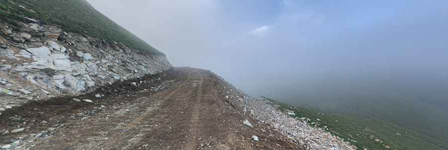
Is the road to Uzungöl Plateau unpaved?
The road to the summit is totally unpaved. It’s a very challenging drive, with narrow sections, steep parts, and dangerous drop-offs. A 4x4 vehicle is required.
How long is the road to Uzungöl Plateau?
Starting from Dağönü, the road to the summit is 10.4 km (6.46 miles) long. Over this distance, the elevation gain is 852m and the average gradient is 8.19%.
Is the road to Uzungöl Plateau open in winter?
The road is impassable in winter. The best time to drive to Uzungöl is during July-August.
Pic: Abdulkadir Keleş