Ilgar Dagi Gecidi in Ardahan Province: The Ultimate Road Trip Guide
Ilgar Dağı Geçidi is a high mountain pass at an elevation of 2,550m (8,366ft) above sea level, located in the Ardahan Province of Turkey. It’s one of the highest paved roads in the country.

Is the road to Ilgar Dagi Gecidi paved?
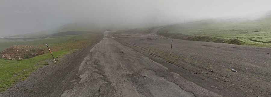
Set high in the Kackar Mountains of the Caucasus, the road to the summit is paved but in very bad conditions. Road conditions are deteriorating due to snow. It’s called D955 (part of the E691 European Route).
How long is Ilgar Dagi Gecidi?
Tucked away in the northeastern part of the country, the road through the summit is 75.6 km (46.97 miles) long, running south-north from Ölçek (a village in the Ardahan District) to Türkgözü (a village in the Posof District), on the Georgian border.
How challenging is it to drive through Ilgar Dagi Gecidi?
At the summit, there’s a big parking lot. Due to the high elevations and exposure, the summit is subject to strong winds and rapid weather changes. The road is very steep, with an average gradient of more than 10%. It is difficult to keep the pass open to traffic during the winters because of the harsh weather conditions at high altitudes.