How to Get by Car to Lac de Chateaupre in the Heart of Valais?
Lac de Châteaupré is a high mountain lake at an elevation of 2,357m (7,732ft) above sea level, located in the municipality of Grimentz, in Switzerland.
Where is Lac de Châteaupré?
The glacial lake is located in the district of Sierre, in the heart of the canton of Valais, in the southern part of the country, not far from the Italian border. It's said to be one of the nicest lakes in the world.
Is the Road to Lac de Châteaupré Paved?
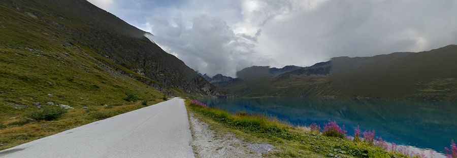
The road to the lake is fully paved and was completed in the 1950s. It’s commonly known as Route de Moiry. Expect a narrow road unprotected by guardrails. This very scenic route runs along Lac de Moiry (Lake Moiry) as well and offers breathtaking views of glaciers and high, snow-capped mountains. The road ends at a large parking lot, north of the lake. The parking lot at the end of the road is the usual starting point to visit the stunning Glacier du Moiry.
How Long is the Road to Lac de Châteaupré?
Starting from Grimentz, the road to the lake is 9.9 km (6.15 miles) long.
Is the Road to Lac de Châteaupré Open in Winter?
Set high in the Val d’Anniviers, this road is usually open from the end of June until the first big snowfall.
Pic: Diário de Bordo de um Caminhoneiro