Take the Scenic Route and Discover Sanetsch Pass in Switzerland
Col du Sanetsch is a high mountain pass at an elevation of 2,250m (7,381ft) above sea level, located in the canton of Valais, in Switzerland.

Where is Col du Sanetsch?
The pass is located in the southwestern part of the country, high in the western Bernese Alps, at the foot of the Glacier de Tzanfleuron. The road is closed to private vehicles.
Is the road to Col du Sanetsch paved?
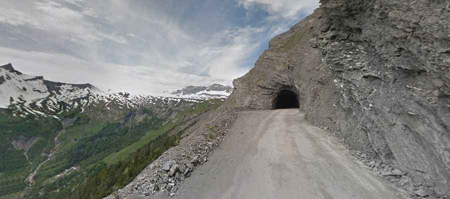
The road to the summit, also known as Col de Sénin, is totally paved. It’s called Route du Sanetsch. Surrounded by nature and truly exciting landscapes, the road is quite lonely. The road to the summit starts with a little steep climb through vineyards, but suddenly the environment becomes forested with waterfalls. The last part of the climb features a tunnel, 800m in length. It’s extremely dark with just a little bit of light inside. The tunnel – high, in the middle of nowhere – has automatic light sensors. It is long and wet, but it has a few openings for views… or to hide from cars.
How long is the road to Col du Sanetsch?
Starting at Conthey (in the district of Conthey in the canton of Valais), the road is 25.9 km (16.09 miles) long. Beyond the lake, the road leads to Lac de Sanetsch, also known as Lac de Sénin. The road was built for the construction of the reservoir.
How steep is Col du Sanetsch?
It’s said to be the most demanding climb in Valais, with some ramps hitting a maximum gradient of 14.5%. Locals call it the Swiss version of the famous Passo Stelvio.
Is the road to Col du Sanetsch open?
The road is open only from June through September. Driving the road without stopping will take most people between 45 and 60 minutes. At the summit is a big parking lot. Remember the wind blows hard at the top. The drive includes views of the Diableret glacier.