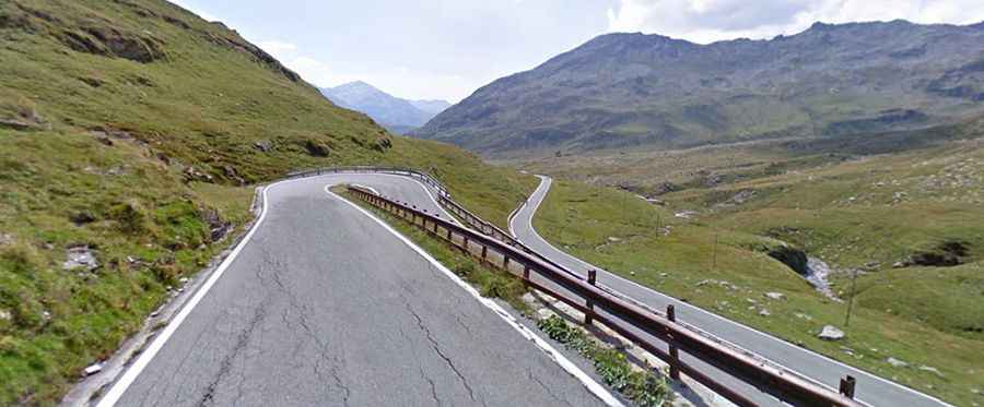
Splügen Pass is an exciting Alpine pass
Splügen Pass is an international high mountain pass, at an elevation of 2,121m (6,958ft) above sea level, located on the border of Switzerland and Italy. Hairpins and great views make this one to see and drive. It's one of the highest paved roads in the Alps.

Where is Splügen Pass?
Set high in the Alps mountain range, the pass links the Swiss Hinterrhein valley and Splügen in the canton of Graubünden with the Valle Spluga and Chiavenna in the Italian province of Sondrio. The road through the pass marks the boundary between the Lepontine and Rhaetian Alps, respectively part of the Western and Eastern Alps.
When was Splügen Pass built?
The pass has a long story and was already in use in Roman times. The first part of this road, from Chur to Bellinzona, was built between 1818 and 1823, and it had numerous civil engineering structures and a slight and even gradient thanks to many hairpin bends. However, Splügen Pass was already crossed by foot in Roman times. Just before the top of the pass, you’ll encounter an exceptional example of road-building skill, the 312-metre-long avalanche gallery, built in 1843.
How long is Splügen Pass?
The road to the summit (known as Splügenpass and Passo dello Spluga) is totally paved. It’s called Strada Statale 36 (SS36). Previously, the road surface was very poor here, but it has been improved somewhat. The pass is 36.7 km (22.80 miles) long, running south-north from Chiavenna (Province of Sondrio in Italy) to Splügen (in the Swiss canton of Graubünden).
Is Splügen Pass challenging?
The variety makes this one of the most gorgeous drives. It's a challenging and rewarding road to drive. This is a stunning road that twists and turns ever upwards but also has several long straights and sweeping curves. One minute, you’re switchbacking your way through tunnels literally stacked on top of each other within the mountain, heading past sharp vertical drops providing stunning views into the valley. The next minute, you’re sweeping through lovely Alpine meadows. It’s one of the famous hairpinned roads in the world.
How is the road to Splügen Pass?
This pass has a high regard among cyclists, mostly because of the difficult and exciting south side. The north (Swiss) side is a wide road and serpentines out of the little village of Splügen, then it narrows a bit through trees - snaking rather than twisting, then out above the trees on a long straight. Up a steep narrow set of hairpins on a very good surface to the Swiss border crossing. Then there's a no-man's-land up more difficult narrow and steep hairpins and over the top to the Italian border. Watch out; the hairpins aren't signposted. Just before you reach the crest of the pass, a series of 10 of the most ridiculously laid-out hairpin bends present. On the Italian side after the border, the road continues up with fewer hairpins and a similarly good surface. This side is extremely steep. The hairpins are in unlit tunnels with poor surfaces. Watch out for cattle on the road. On the descent, there are a few grim-looking villages and a few more hairpins leading to a fast road beside a reservoir. There are a couple of dark galleries before the village of Pianazzo. After Chiavenna, there are a large number of narrow galleries and unlit tunnels, some with bends in them or even hairpins. The road can be wet and therefore slippery even in dry weather.
Is Splügen Pass open?
This road is usually impassable from late October through late June or early July (depending on snow). The opening and closing dates all depend on snowmelt and snowfall each year. Since the construction of the tunnel through San Bernardino, the pass has lost its former importance.
Is Splügen Pass worth it?
The road offers spectacular views over the valley from the road in the rocks, and the tarn Lago di Monte Spluga near the top. Near the top, some incredible views of the distant snow-covered peaks and valleys become visible. There are water and restaurants on the south side if you need to stop. The road is very busy on weekends and summer holidays.