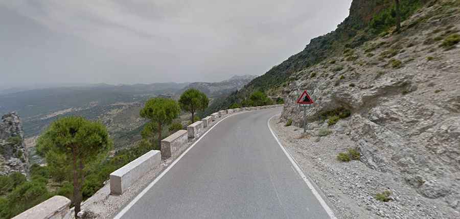
A winding road with steep slopes to Puerto de las Palomas
Puerto de las Palomas is a mountain pass at an elevation of 1,190m (3,904ft) above sea level, located in the province of Cádiz, in Spain.
Where is Puerto de las Palomas?
The pass is located in the southwestern part of the autonomous community of Andalusia, within the Sierra de Grazalema Natural Park, in the southern part of the country. Although there is a sign at the summit with the altitude (1,357 meters above sea level), this altitude is wrong.
Is Puerto de las Palomas paved?
The winding road to the summit is totally paved. It’s called CA-9104. The drive features countless curves and hairpin turns. The road is very steep, hitting a 14% maximum gradient through some of the ramps.
How long is Puerto de las Palomas?
The pass is 15.7 km (9.75 miles) long, running north-south from Zahara de la Sierra to Puerto del Boyar, near Grazalema. The road is typically open all year round, with the occasional closure in winters.
Is the drive through Puerto de las Palomas worth it?
The summit hosts a small parking lot. There are great views from the summit, and there's a nice hiking path to see the northern part of the provinces of Cadiz and Málaga as well as the southern part of Seville.