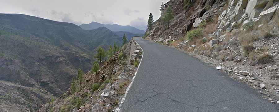
Carretera de las Presas (Road GC-605) is not for the faint-hearted
Known as Carretera de las Presas, the GC-605 is a wonderful and scenic, dangerous mountain road located in the southwestern part of the island of Gran Canaria, in the Canary Islands of Spain. The maximum slope is 10%.

How long is Carretera de las Presas?
The road is 23.3 km (14.47 miles) long and runs from the small town of Pie de la Cuesta at 325m above sea level to Ayacata, a small village with some bars and restaurants, at 1,304masl. Over this distance, the elevation gain is 979 meters and the average gradient is 4.20%. Starting from Pie de la Cuesta, the first section is an epic series of hairpin bends winding up the west side of the valley past ochre cliffs and huge boulders. The GC-605 hairpins its way up the Mogan Valley until it reaches the summit at Ayacata village.
How challenging is Carretera de las Presas?
The road is fully paved, but its surface for the last 8 km varies widely from ok to horrible. It’s a pretty demanding drive, and the road has humbled many egos as some sections are very narrow, impassable for 2 cars at the same time. Expect more than 30 hairpin turns. The maximum slope is 10%.
How to get to Presa Las Niñas by car?
The road leads to Las Niñas reservoir. It is one of the three largest dams in the center of the island. The reservoir is shrouded in legend and mystery. A 400-year-old pine tree close by is said to have witnessed a woman being burned to death. Today the tree, which has survived several forest fires, stands in silhouette opposite the campsite.
Is Carretera de las Presas worth the drive?
It’s one of the best scenic drives on the island. This treacherous mountain route is prone to landslides, rockfalls, and fog. Along the way, not for the faint-hearted, there are some natural viewpoints with parking lots. It can be very cold and windy.