A scenic paved road to Puerto de Navafría
Puerto de Navafría is a high mountain pass at an elevation of 1.775m (5,823ft) above sea level, located on the border between Castile and Leon and Madrid communities, in Spain.
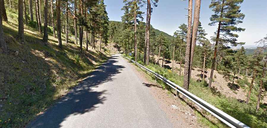
Is the road to Puerto de Navafría paved?
Located in the central part of the country, the winding road to the summit is fully paved but narrow and bumpy. It’s called M-637 (southern side) and SG-612 (northern side).
How long is Puerto de Navafría?
The pass is 23km (14 miles) long, running north-south from the N110 road (near Navafría) to the M604 (near Lozoya).
How steep is Puerto de Navafría?
The climb is very steep, hitting a 10% of maximum gradient through some of the ramps. The climb has been featured in the Spanish Vuelta race.
Is Puerto de Navafría worth the drive?
Located in the Sierra de Guadarrama, and surrounded by trees, the drive offers great panoramic views. At the summit there is a ski station.