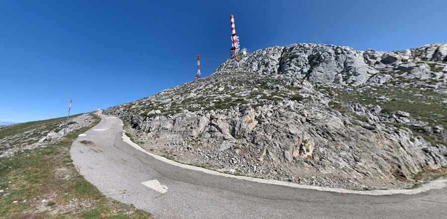
A brutally steep road to Alto del Gamoniteiro
Alto del Gamoniteiro is an isolated and remote high mountain peak at an elevation of 1,776m (5,826ft) above sea level, located in Asturias, in Spain. The climb is very steep, hitting a grueling 17% through some of the ramps. It’s said to be the highest paved road in Asturias.

Where is Alto del Gamoniteiro?
The peak, also known as Alto del Gamoniteiru, is located to the south of the globally famous Alto de l’Angliru, in the Autonomous Community of the Principality of Asturias, in the northern part of the country.
What’s on the summit of Alto del Gamoniteiro?
Set high in the Sierra del Aramo mountain range, the summit of the lofty peaks hosts a small parking lot and communication towers. The drive offers stunning views. If you're afraid of heights, it's probably best to keep your eyes forward. To the north of the summit, a short unpaved road leads to Lago de Cueva, a high mountain lagoon. The road is 2km (1.24 miles) long via 11 hairpin turns.
How long is the road to Alto del Gamoniteiro?
The road to the summit is extremely narrow, with bad asphalt (and concrete sections), a few potholes and very steep parts. Starting from the AS-230 road, the ascent is 6.4 km (3.97 miles) long. Over this distance, the elevation gain is 625 meters. The average percentage is 9.76%.
How steep is the climb to Alto del Gamoniteiro in Asturias?
It is one of the most beautiful climbs in the area. The ramps really hit hard, getting up to 15% at the end of the three, ascending in difficulty, 3km from home, a flattening out for no more than 100m is then followed by a spike up to 13%. The last 1.5 km is also the toughest, averaging no less than 12%, and with a maximum of just 17% that tells you that it's incessant suffering. It's actually kind of strange that the maximum of such a brutal climb is just 17%. The hardest part of the climb is the final kilometer which averages 13.3%. It is said to be the Spanish version of Mont Ventoux without the crowds.
Pic: Minero