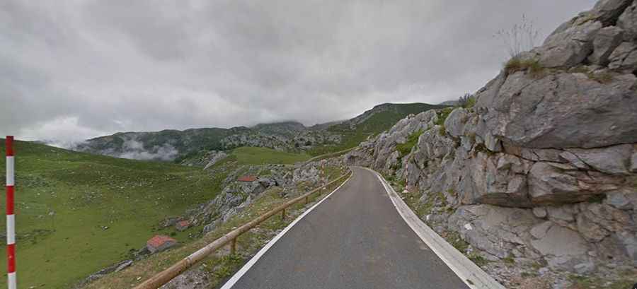
A sensational road to Jito de Escarandi-Alto de Sotres in Picos de Europa
Jito de Escarandi (also known as Alto de Sotres) is a mountain pass at an elevation of 1,308m (4,291ft) above sea level, located in the Picos de Europa mountain range of Spain. The road features sections with a gradient of up to 21%.

Where is Jito de Escarandi-Alto de Sotres?
The summit of this pass (also known as Jitu d'Escarandí) is located on the border between the autonomous communities of Asturias and Cantabria, in the northern part of the country, within the Picos de Europa National Park.
Is the road to Jito de Escarandi-Alto de Sotres paved?
The paved road to the summit is nicknamed ‘Carretera de las 3 villas’ (3 Villages road). It’s said to be one of the roads with the most extraordinary landscapes in the Picos de Europa range, featuring mountains, hills, and meadows. The pass was the summit finish of Stage 15 of the 2015 Vuelta a España. The road is typically open all year round, but short-term closures are common in winter.
How long is the road to Jito de Escarandi-Alto de Sotres?
The pass is 11.5 km (7.14 miles) long, running west to east from Sotres (in Asturias) to Tresviso (in Cantabria). The town is known for the infamous Ruta Urdón-Tresviso, a mule track.
How steep is the road to Jito de Escarandi-Alto de Sotres?
Starting from Sotres, the road is called CA-1. This road has poor asphalt quality, gravel sections, and deep potholes. Ascending from here to the crest of the climb is a difficult 14.5 km with an average gradient of 7.5%. The gradients increase to the highest that Jito de Escarandi has to offer: 2 km at 10.8%, including a 400m stretch averaging 17%, maxing out at 21%, and another 500m at 15%.
Is the road to Jito de Escarandi-Alto de Sotres worth the drive?
At the summit, there’s a wonderful view of the surrounding mountains, which are often covered by fog and are thought to be full of legends and charm. The climb is stunning and offers spectacular views.