If you love to drive, you’ll love the curvy road to Alt de la Talaia in Tarragona
Alt de la Talaia is a mountain pass at an elevation of 561m (1,840ft) above sea level, located in the comarca of Baix Penedès, in Spain.
Where is Alt de la Talaia?
The pass is located in the province of Tarragona and the autonomous community of Catalonia, in the northeastern part of Spain. To the west of the pass, it’s possible to climb up to Coll de l’Arca, a mountain pass at an elevation of 605m (1,984ft) above sea level.
How long is Alt de la Talaia?
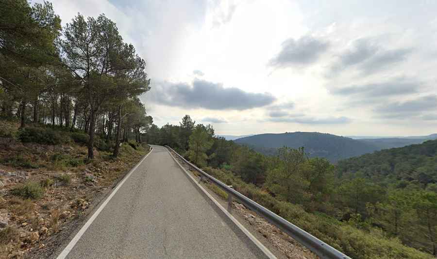
Set high in the Sierra de Montmell mountain range, the road to the summit is fully paved. It’s called TP-2442. The pass is 10.9 km (6.77 miles) long, running from Sant Jaume dels Domenys to Aiguaviva.
How challenging is Alt de la Talaia?
The road is quite challenging, with steep sections, hitting a maximum gradient of 7% through some of the ramps, and numerous curves and 8 hairpin turns. If you’re prone to car sickness, it’s best to avoid it. The drive is extremely curvy. The road is very lonely, and the mountain views of pine trees are stunning. It’s quite narrow in parts.