Driving the Challenging Bujaruelo Valley Road: A Scenic Adventure in the Pyrenees
Bujaruelo Valley Road is a very challenging drive, with concrete and gravel sections located in the northeastern part of Spain. It’s one of the best canyon roads in Spain.
Where is Bujaruelo Valley Road?
The road is located in the midst of the Pyrenees, in the province of Huesca, in the autonomous community of Aragon, in the northeastern part of the country, close to the border with France.
Is Bujaruelo Valley Road paved?
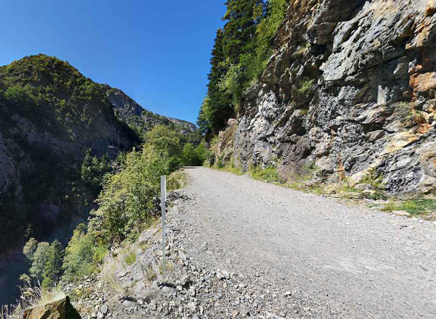
The tiny and scenic canyon road features paved and unpaved sections. Without large potholes or sinkholes that could damage the car if you drive at a moderate speed, the road is open to 2wd vehicles in good weather.
How long is the Bujaruelo Valley Road?
The road is 11.1 km (6.89 miles) long. Running south-north from Puente de los Navarros to Refugio de Pastores del Vado, a high mountain refuge in the Sobrarbe area, at 1.587m (5,206ft) above sea level.
Is the Bujaruelo Valley Road open?
Set in the Pyrenees mountain range, to the west of Port de Boucharo (Puerto de Bujaruelo), the road is usually impassable in winters. The road is open to vehicles unless the last section, beyond Refuge Bujaruelo, where there’s a barrier blocking private motor vehicles.
Is the Bujaruelo Valley Road challenging?
The road runs along the Ara River and features many bridges, including Puente de los Navarros, Puente de Santa Elena, Puente Nuevo, and Puente de Oncins. The road is defiant, with narrow parts and drop-offs, together with steep sections. It has a high risk of rockslides. The drive provides stunning views of the area, and the landscape seen from the car is worth admiring.
Road suggested by: jorge manuel gómez sánchez
Pic: José M. Gómez de Salazar