What are the most spectacular roads in Spain?
Spain, with its rich tapestry of history, culture, and landscapes, is not just a country to be visited; it's a country to be experienced on the open road. From the buzzing plazas of Madrid to the serene villages of Andalusia, every corner of Spain hides a story waiting to be discovered.
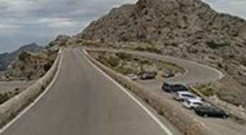
Imagine steering through Sa Calobra Road in Mallorca, often likened to a wet strand of spaghetti dropped on the floor. With its twists, turns, and unparalleled views, it’s a marvel of engineering set amidst nature's grandeur. Then there's the ascent to Pico del Veleta, a journey that doesn’t just climb mountains but touches the sky, making it Europe’s highest paved road.
Drive further and let the road to Formentor Lighthouse in Mallorca mesmerize you with its coastal charms. Each turn is a portrait of the sea meeting the land in a passionate embrace. Meanwhile, the adrenaline junkies might find their calling in Alto de l’Angliru, nestled in Asturias. This challenging ascent has been the playground for many cycling legends, testing their mettle against its grueling gradient.
For a more rhythmic experience, embark on GC-200 Road, a symphony of 365 curves, each echoing a day of the year. As you navigate this sinuous stretch, it offers panoramas that seem painted by the gods themselves.
As you cruise these Spanish roads, each kilometer unravels a tale, a flavor, or a melody of this vibrant land. So, rev up your engines and let Spain's spectacular routes guide you through a journey of soulful discoveries and unforgettable vistas. You will discover many treasures created by skilled workers employed by construction firms with tradition in Spain.
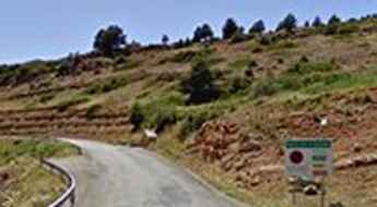
Carretera de las Presas (Road GC-605) is not for the faint-hearted
Known as Carretera de las Presas, the GC-605 is a wonderful and scenic dangerous mountain road located in the southwestern part of the island of Gran Canaria, in the Canary Islands, Spain. The maximum slope is 10 %.
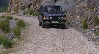
Pista de las Cutas, an amazing gravel road surrounding the valley of Ordesa
Pista de las Cutas is one of the most scenic drives in Spain. Located in the northwest of the Sobrarbe region, in Huesca province, Aragon, Spain, bordering France, the road offers spectacular views of Ordesa and Monte Perdido.
Peña de Francia, is an otherworldly drive
Peña de Francia is a high mountain pass at an elevation of 1.708m (5,603ft) above the sea level, located south of the city of Salamanca, in the Autonomous Region of Castile and León, Spain.
Driving the curvy TF-12 road in Canary Islands
Located on the island of Tenerife, in Spain’s Canary Islands, the TF-12 road is, probably, one of the most enjoyable routes to cycle in the whole of Spain. This quiet highway cuts through the Anaga mountain range.
Port de Cantó, a paved road in the heart of the Pyrenees
Port de Cantó is a high mountain pass at an elevation of 1.725m (5,659ft) above the sea level, located in the Pyrenees, a range of mountains in southwest Europe, in Alt Urgell zone, Catalonia, Spain.
A-7000, an enthralling road with 2 pigtails
A-7000 is an awe-inspiring drive through the mountains, located in the Autonomous Community of Andalusia, in Southern Spain. The road features 2 pigtails, turns which loop over their own road, allowing the road to climb rapidly.
A scenic paved road to Puerto de Navafría
Puerto de Navafría is a high mountain pass at an elevation of 1.775m (5,823ft) above the sea level, located on the boundary of Castile and Leon and Madrid, in central Spain.
A 5 stars road to the top of Puerto de Santa Inés
Puerto de Santa Inés is a high mountain pass at an elevation of 1.755m (5,757ft) above the sea level, located in the province of Soria, in the autonomous community of Castile and León, in central Spain.
Driving the wild Port de Cabus in the Pyrenees
Port de Cabús is an international high mountain pass at an elevation of 2.308m (7,572ft) above the sea level, located on the Andorran-Spanish border. It's one of the highest roads of the country.
A scenic road to Port-Ainé, in the Pyrenees
Port-Ainé is a ski resort at an elevation of 1.967m (6,453ft) above the sea level, located in the province of Lleida and autonomous community of Catalonia, in northern Spain.
Pantà de Cavallers: a steep paved road to the reservoir
Pantà de Cavallers is a high mountain reservoir at an elevation of 1.770m (5,807ft) above the sea level, located in the province of Lleida, in Catalonia, Spain.
A dirt track to the summit of Pic Negre
Pic Negre is an international high mountain peak at an elevation of 2.643m (8,671ft) above the sea level, located on the Andorran-Spanish border. It's one of the highest roads of the country.
If you love to drive, you will love the Mont Caro road
Mont Caro is a mountain pass at an elevation of 1.447m (4,747ft) above the sea level, located in the the Ports de Tortosa-Beseit range, in Catalonia, Spain. The summit is heavily built and partly occupied by big buildings and huge antenna masts. The road to the summit is narrow and dangerous, especially in winters.
The inhumane climb to Miradoiro do Ézaro
Mirador de Ézaro is a mountain pass at an elevation of 268m (879ft) above the sea level, located in northwestern Spain in the province of A Coruña, in the autonomous community of Galicia. It’s one of the steepest roads that a Spanish bike race has ever tackled where you directly ride against uphill over a huge rock.
A steep paved road to Alto de Lubián
Alto de Lubián is a high mountain peak at an elevation of 1.681m (5,515ft) above the sea level, located in the province of Zamora, Castile and León, in northern Spain.
A brutal road (20%) to Navapelegrín
Navapelegrín is a high mountain pass at an elevation of 1.710m (5,610ft) above the sea level, located in the Province of Segovia, in the Castilla-La Mancha Autonomous region of central Spain.
Pico Tres Mares, a wild road to the summit
Pico Tres Mares is a high mountain peak at an elevation of 2.139m (7,017ft) above the sea level, located on the border of the Autonomous Communities of Cantabria and Castile and León, in northern Spain. It’s one of the highest roads of the country.
Olerdola Castle is a classic road trip
Castell d’Olerdola sits at an elevation of 314m (1,033ft) above the sea level, in the comarca of the Alt Penedès in Catalonia, Spain. The road to the castle is pretty steep, with sections up to 10%.
An old, narrow road full of holes to the top of Los Pelaos
Los Pelaos is a high mountain peak at an elevation of 1.873m (6,145ft) above the sea level, located in the Spanish province of Granada, in the Alpujarra mountains, in the Sierra de Lujar range. The climb is really hard with sections up to 17%. It’s an old, narrow road full of holes. Expect 13 hairpin turns.
Pista Espinama-Sotres, a Most Tricky Scenic Drive
The Espinama-Sotres, also known as Ruta de la Reconquista, is a very exciting drive in the heart of Picos de Europa National Park, in Northern Spain.
Collado El Gavilán, a steep paved road to the summit
Collado El Gavilán is a high mountain pass at an elevation of 1.517m (4,977ft) above the sea level, located in the province of Teruel, Aragon, Spain.
Col d'Arnostéguy: a mule track to the summit
Col d'Arnostéguy is an international mountain pass at an elevation of 1.240m (4,068ft) above the sea level, located on the Spanish-French border.
Puerto El Peñón, a delightful yet challenging road to the summit
Puerto El Peñón is a high mountain pass at an elevation of 1.840m (6,036ft) above the sea level, located on the boundary of León and Zamora provinces, in Castile and León, Spain.
Silla de la Yegua: Ultimate 4wd destination
Silla de la Yegua is a high mountain peak at an elevation of 2.135m (7,004ft) above the sea level, located in the Province of León in the autonomous region of Castile and León, in northern Spain.
Garganta del Cares is one of the most difficult roadsof Spain
Garganta del Cares, also known as Garganta Divina (Divine Throat), is a very narrow canyon located in the province of León, in the northwestern part of the autonomous community of Castile and León of northwestern Spain. It’s one of the most scenic canyon roads of Spain.
A paved road to Estación de Esquí de Aramón Valdelinares
Aramón Valdelinares is a ski resort at an elevation of 1.975m (6,479ft) above the sea level, located in the province of Teruel, in the mountainous Aragon region of eastern Spain.
A memorable road trip to Coll dels Reis in Mallorca
Coll dels Reis is a mountain pass at an elevation of 658m (2,158ft) above the sea level, located on the northwest coast of the Spanish Balearic island of Mallorca. It’s one of the most visited by cyclists spots on the island.
The road to Aramón Formigal with 10% ramps
Aramón Formigal is a ski resort at an elevation of 1.790m (5,872ft) above the sea level located in the province of Huesca, in Aragon, northeastern Spain.
The road to Lago de Urdiceto is not for the faint of heart
Lago de Urdiceto (Ibón de Urdiceto) is a high mountain reservoir at an elevation of 2.380m (7,808ft) above the sea level, located in the comarca of Ribagorza, province of Huesca, in northern Spain. It’s one of the highest roads of the country.
The Wild Road to Coll de Triadó
Coll de Triadó is a high mountain pass at an elevation of 2.172m (7,125ft) above the sea level, located in the municipality of La Torre de Cabdella, in the province of Lleida in the autonomous community of Catalonia, in northern Spain.
Lagos de Covadonga, an iconic Vuelta a España climb
Lagos de Covadonga is the name given to a couple of glacial lakes (Lake Enol and Lake Ercina) ending at an elevation of 1.134m (3,720ft) above the sea level, located in the region of Asturias, in northern Spain. The road is a popular climb in professional road bicycle racing, with ramps up to 15%. It's said to be one of the most beautiful drives of the country.
A rough and bumpy road to Pico de los Reales
Pico Los Reales is a mountain pass at an elevation of 1.447m (4,747ft) above the sea level, located in the province of Málaga, part of the autonomous community of Andalusia, in southern Spain.
Travel guide to the top of Morrón de Espuña
Morrón de Espuña is a high mountain peak at an elevation of 1.574m (5,164ft) above the sea level, located in Murcia region, in southeastern Spain.
A paved road to Saut deth Pish waterfall
Saut deth Pish is a spectacular waterfall in the valley of Barradòs, in the Val d'Aran, a valley in the Pyrenees mountains in the northwestern part of the province of Lleida, in Catalonia, northern Spain. The fall is located at an elevation of 1.553m (5,095ft) above the sea level.
Coll de Pal, an amazing hidden gem in the Catalan Pyrenees
Coll de Pal is a high mountain pass at an elevation of 2.109m (6,919ft) above the sea level, located in the comarca of Berguedà, in Catalonia, Spain.
Sierra Nevada, a classic road trip
Sierra Nevada is a ski resort at an elevation of 2.385m (7,824ft) above the sea level, located in the province of Granada, Andalusia, in southeastern Spain. It’s one of the highest roads of the country.
A paved scenic road to Coll de la Creueta
Coll de la Creueta is a high mountain pass at an elevation of 1.880m (6,167ft) above the sea level, located in the comarca of the Berguedà in Catalonia, northern Spain.
A scenic paved road to the summit of Calar Alto
Calar Alto is a high mountain pass at an elevation of 2.168m (7,113ft) above the sea level, located in the province of Almería, in Andalusia, southern Spain. It's one of the highest mountain roads of Spain.
A paved steep road to La Covatilla
La Covatilla is a high mountain peak at an elevation of 1.962m (6,437ft) above the sea level, located in the south of Province of Salamanca, in Castile and León, Spain. It is one of the hardest climbs in the area.
Road trip guide: Conquering La Rinconada de Nigüelas
La Rinconada de Nigüelas is a high mountain pass at an elevation of 2.174m (7,132ft) above the sea level, located in the province of Granada, in southern Spain’s Andalusia region It's one of the highest roads of Spain.
A steep paved road to Alto del Moncalvillo
Alto del Moncalvillo (Cima del Serradero) is a mountain peak at an elevation of 1.480m (4,855ft) above the sea level, located in the autonomous community of La Rioja, in northern Spain.
Driving the absolutely beautiful LP-4 Road
LP-4 Road, known as Carretera del Roque, is an absolutely beautiful road, with many different turns and twists, almost without traffic located in the province of Santa Cruz de Tenerife of the Canary Islands. It's one of the highest roads of the country.
Travelling through the challenging Old N-320 Road
Antigua Carretera N-320 is a cliff road located in Sacedón, in the province of Guadalajara, Castile-La Mancha, in Spain. The road was bypassed by a new highway but is still in use. It can be impassable anytime due to stone collapses and landslides. It’s one of the most scenic canyon roads of Spain.
Jito de Escarandi-Alto de Sotres, a sensational road in Picos de Europa
Jito de Escarandi (also known as Alto de Sotres) is a mountain pass at an elevation of 1.308m (4,291ft) above the sea level, located within the Picos de Europa National Park, in the Picos de Europa mountain range, in northern Spain. The road features sections up to 21% in gradient.
Driving the wild road to Col de Caralps in the Pyrenees
Col de Caralps is an international high mountain pass at an elevation of 2.501m (8,205ft) in the Pyrenees, on the French-Spanish border. It’s one of the highest roads of the country.
