Travelling the General Wade’s Military Road from Inverness to Fort Augustus
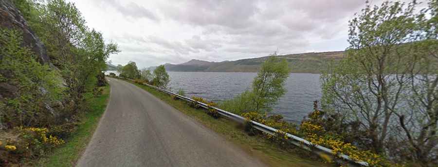
Located on Scotland’s northeast coast, General Wade’s Military Road is a very scenic journey along the southern shore of Loch Ness. Remember to bring your camera for the stunning views.
When was General Wade's Military Road built?
The road follows the route of a military road laid out under General George Wade, built between 1725-1727 across Ashie Moor. The original route was difficult to traverse in winter and bad weather (it was blocked by snow in the first few winters), so in 1732 it was built the current road. From 1724-1740 General Wade served as Commander in Chief of the British army. It is not unusual to see deer on the road.
Can you drive General Wade's Military Road?
The drive is totally paved and comprises B862 and B852 roads. This nice and twisty road with superb views can pose a challenge to even the most experienced drivers. It’s very narrow with passing places for the most part and should not be untaken by the fainthearted. Caution is required on the (many) blind bends.
How long is General Wade’s Military Road?
Tucked away on the Scottish Highlands, the road is 51km (32 miles) long and features magnificent views at almost every turn. It links Inverness and Fort Augustus
How long does it take to drive the General Wade’s Military Road?
To drive the road without stopping will take most people between 60 and 75 minutes. There are places to stop for photographs. Be careful when parking your vehicle. Expect a wonderful scenery with very little traffic.