An Unforgettable Steep Drive to Alto de Sao Macario in Portugal
Alto de São Macário is a mountain peak at an elevation of 1.052m (3,451ft) above sea level, located in the district of Viseu, in the Central Inland of Portugal.
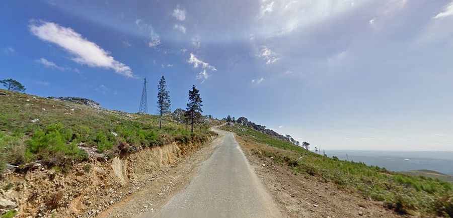
Is Alto de São Macário paved?
Set high in the Maciço da Gralheira mountain range, the road to the summit is totally paved but pretty narrow and very steep. It’s called CM1123.
How long is the road to Alto de São Macário?
The road to the summit is very steep, hitting a 14% of maximum gradient through some of the ramps. Starting at Sul, the ascent is 9.3 km (5.77 miles) long. Over this distance the elevation gain is 812 meters. The average gradient is 8.73%.
Is Alto de São Macário worth it?
The summit hosts a monastery (Santuario de São Macário) and communication facilities. From the top, you have an amazing view, especially when the weather is clear.