Driving the Wild 4x4 Road to Marao Peak
Marão is a mountain peak at an elevation of 1,413m (4,635ft) above sea level, located on the boundary between the Vila Real and Viseu districts of Portugal.

Where is Marão Peak?
The peak is located in the Douro region in the northern part of Portugal. The Serra do Marão area was historically involved in tungsten extraction, which was heavily used during World War II.
What’s at the Summit of Marão Peak?
The summit hosts various constructions, including an observatory lookout, a mountain refuge, a tiny chapel (Capela da Senhora da Serra), and communication antennas. On clear days, it’s possible to see the Atlantic Ocean from the summit.
Is the Road to Marão Peak Paved?
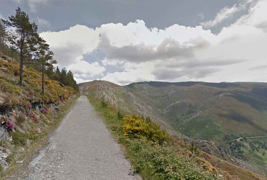
The road to the summit is extremely narrow with dangerous drop-offs and is entirely paved. However, due to its poor condition—partly broken with potholes and loose gravel—a 4x4 vehicle is recommended.
How Long is the Road to Marão Peak?
Starting from Alto de Espinho on the old N15 road, the route to the summit is 8.9km (5.53 miles) long. Over this distance, the elevation gain is 397 meters, with an average gradient of 4.46%.
Road suggested by: Jorge Manuel Gómez Sánchez