Driving the Scenic Route Varanger in Norway
National Tourist Route Varanger is a very scenic drive along the Varanger Peninsula in the county of Finnmark, in Arctic Norway. It's one of the famous scenic drives in Norway.
How long is National Tourist Route Varanger?
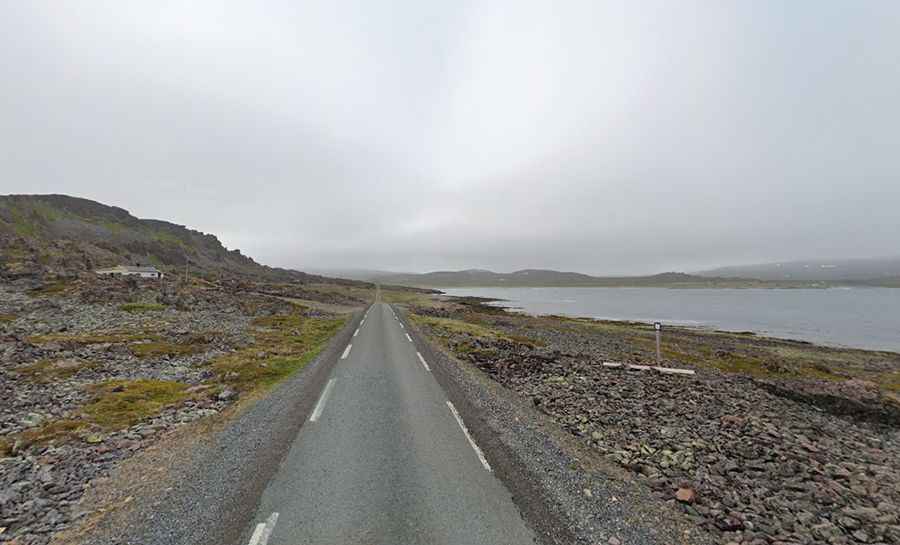
The coastal road is totally paved. It’s 160km (99 miles) long, running from Varangerbotn to Hamningberg, following the coast towards the ice-cold Barents Sea. The Varanger national tourist route was designated in 2012 and comprises Norway roads E75 and 341. The road is narrow in parts and requires careful driving.
Is National Tourist Route Varanger open?
Tucked away in Norway’s farthest northeastern corner, where hard rock meets the Barents Sea, the road is usually closed from November until May. It begins among the sheltered birch forests and bogs of Varangerbotn and ends in a lunar landscape of jagged cliffs at the world's end. It tops out at 123m (403ft) above sea level.
How long does it take to drive the National Tourist Route Varanger?
To drive the road without stopping will take most people between 2.5 and 3.5 hours. This route offers a contrast-filled journey through scenery characterized by its Arctic climate. Varanger is one of the regions of Northern Europe that is richest in bird life and features in the book "Top 100 Birding Sites of the World." Fisheries, migration, and trade have turned Varanger into a melting pot of peoples and cultures.
Facts:
Roads: Road 75/341
Length: 160km
Highest elevation: 123m asl
Ferries: 0
Winter notice: Hamningbergveien between Smelror and Hamningberg is closed during the winter.