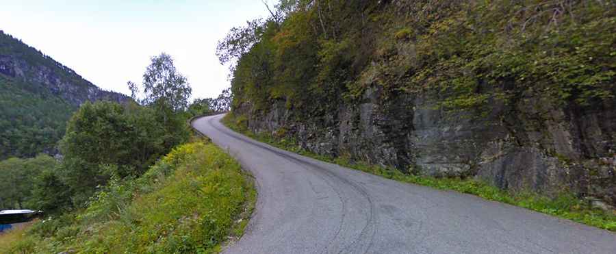
Stalheimskleiva is the steepest road in Northern Europe
Located in Norway, the infamous Stalheimskleiva is one of Northern Europe's steepest stretches of road, boasting a brutal gradient of 20% and offering a fantastic view.

Where is Stalheimskleiva?
The road, also known as Stalheimskleivi or Stalheimskleiven, is located a few miles north of Voss, in Vestland county, in the western part of Norway.
How long is Stalheimskleiva?
The serpentine mountain road is 1.9 km (1.18 miles) long. It’s completely paved and runs east-west, from Nærøydalsvegen 351 road to Stalheimsvegen 132 road.
Is Stalheimskleiva challenging?
There are a total of thirteen hairpin bends on the road, making it one of the most famous hairpinned roads in the world. It's very narrow, often requiring reduced speeds as vehicles navigate the hairpin turns. Previously accommodating traffic in both directions, it is now a one-lane road, possibly due to tourist buses.
Is Stalheimskleiva steep?
The road is exceptionally steep, with a maximum gradient of 20% through some of the ramps. With this gradient, it’s considered one of the steepest roads in Northern Europe. The elevation gain is 244 meters, and the average gradient is 12.84%.
Is the Stalheimskleiva road open?
This road, nicknamed ‘the road between the waterfalls,’ is usually impassable from late October through late June or early July (depending on snow and ice). It is currently closed to traffic until further notice due to maintenance work, and there's a possibility it might close permanently due to heavy traffic impact.
When was the Stalheimskleiva road built?
The road was constructed by manual labor between 1842 and 1846, involving around 1,000 men. It was widened in 1937 to accommodate cars and gradually asphalted. Its initial purpose was to improve the postal route between Oslo and Bergen.
Is Stalheimskleiva worth it?
This is a remarkable road trip, taking approximately 6 minutes to complete the drive. Today, the road is primarily used by tourists. Along the way, you can experience magnificent views of the UNESCO World Heritage-listed Nærøydalen valley. The Stalheimskleiva road ascends a ridge between two cascading waterfalls: the Sivlefossen waterfall to the north, with a fall of about 140 meters, and the Stalheimsfossen waterfall to the south, boasting a fall of 126 meters.