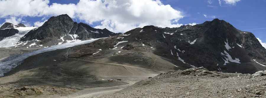
Im Hinteren Eis
Im Hinteren Eis is a high mountain peak at an elevation of 3.030m (9,940ft) above the sea level, located in South Tyrol in northern Italy. It’s one of the highest roads of Europe.
The road to the summit, located in the Ötztal Alps, is gravel, rocky, tippy and bumpy at times. It’s a chairlift service access road. The road is usually impassable from October to June (weather permitting). Great trail for experienced wheelers. Avoid driving in this area if unpaved mountain roads aren't your strong point. 4x4 vehicle required. Stay away if you're scared of heights. Expect a trail pretty steep. Thunderstorm activity can quickly change unpaved roads to four-wheel-drive condition or make them impassable.
It’s one of the highest roads of the country. The summit offers a spectacular view of the Hintereisferner glacier. The wind is usually quite strong at mountain areas. High winds blow here all year long. Even in summer you can confront with snowy days. Temperatures here in the winter are brutally cold. With such a high summit altitude the road can be closed anytime due to snowfalls. The zone is prone to heavy mist and can be dangerous in low visibility conditions.
Pic: Hel Lovelt