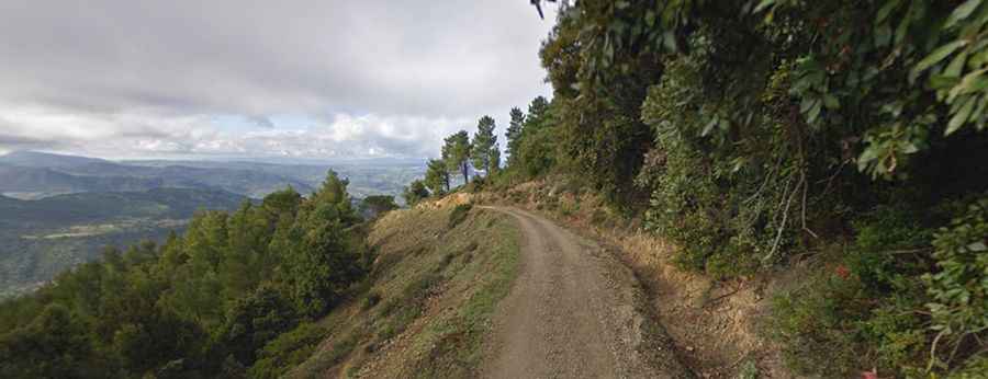
The Unpaved Road to Monte Corrasi in Sardinia Runs Through a Lunar Landscape
Monte Corrasi is a high mountain peak at an elevation of 1,463m (4,799ft) above sea level, located in the autonomous island region of Sardinia, Italy. It’s said to be one of the wildest and most remote drives in the Mediterranean.

Where is Monte Corrasi?
The peak is located in the province of Nuoro, on the eastern coast of the island, within the Parco Nazionale del Golfo di Orosei e del Gennargentu.
Why is Monte Corrasi Famous?
The summit looks like a lunar landscape because high winds leave it mostly barren. It is characterized by a rocky environment with peculiar geomorphological elements such as karstic flats, caves, gullies, aiguilles, and pinnacles with unusual shapes. The summit offers breathtaking views into the valley below.
Is the Road to Monte Corrasi Unpaved?
The road to the summit is called Strada del Monte Corrasi. It’s completely unpaved, very narrow, and brutally steep, featuring 25 hairpin turns. The ascent follows a forest road, sometimes shortcutting several of the curves. A high-clearance vehicle is required.
Is the Road to Monte Corrasi Open?
Set high in the Supramonte mountain range, the road is blocked to private vehicles at a parking lot near the summit, but it’s entirely drivable to that point.
How Long is the Road to Monte Corrasi?
Starting from Strada Provinciale 22 (SP-22), the road to the summit is 6.2 km (3.85 miles) long. Over this distance, the elevation gain is 751m, and the average gradient is 12.11%.
Road suggested by: Hugh Wilson