How to get by car to Lago di Malciaussia?
Lago di Malciaussia is a high mountain lake at an elevation of 1,823 m (5,980 ft) above sea level, located in the Metropolitan City of Turin, in Italy.
Where is Lago di Malciaussia?
The lake is located in the upper Valle di Viù, in the Piedmont region, in the northwestern part of the country, near the French border. Near the lake, there’s a restaurant and a hotel.
Why is it called Lago di Malciaussia?
The lake is named after the locality Malciaussia, which was submerged when it was filled.
When was the road to Lago di Malciaussia built?
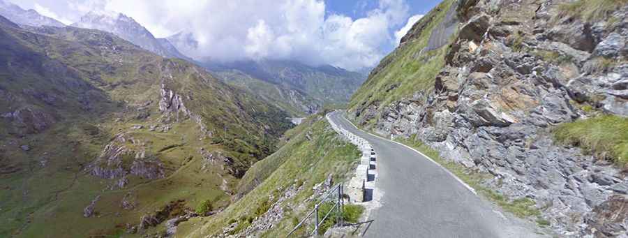
The road is very scenic and was built in the 1920s and 1930s. The valley road terminates at this lake, which makes it a convenient starting point for walking and climbing in the high Alps.
Is the road to Lago di Malciaussia paved?
The road to the lake is called Strada Provinciale 32 (SP32). It’s paved, pretty narrow, and steep, very steep, with sections up to 23%. The last meters of the road are gravel and are the starting point for walking and climbing in the high Alps. From here, one can ascend Rocciamelone (3,538 m) via the alpine hut “Ernesto Tazzetti”.
How long is the road to Lago di Malciaussia?
Starting from the town of Margone, at 1,413 m, the ascent is 5.8 km (3.60 miles) long via 14 hairpin turns. Over this distance, the elevation gain is 410 meters. The average gradient is 7.06%.